Baju-Baghu Loop
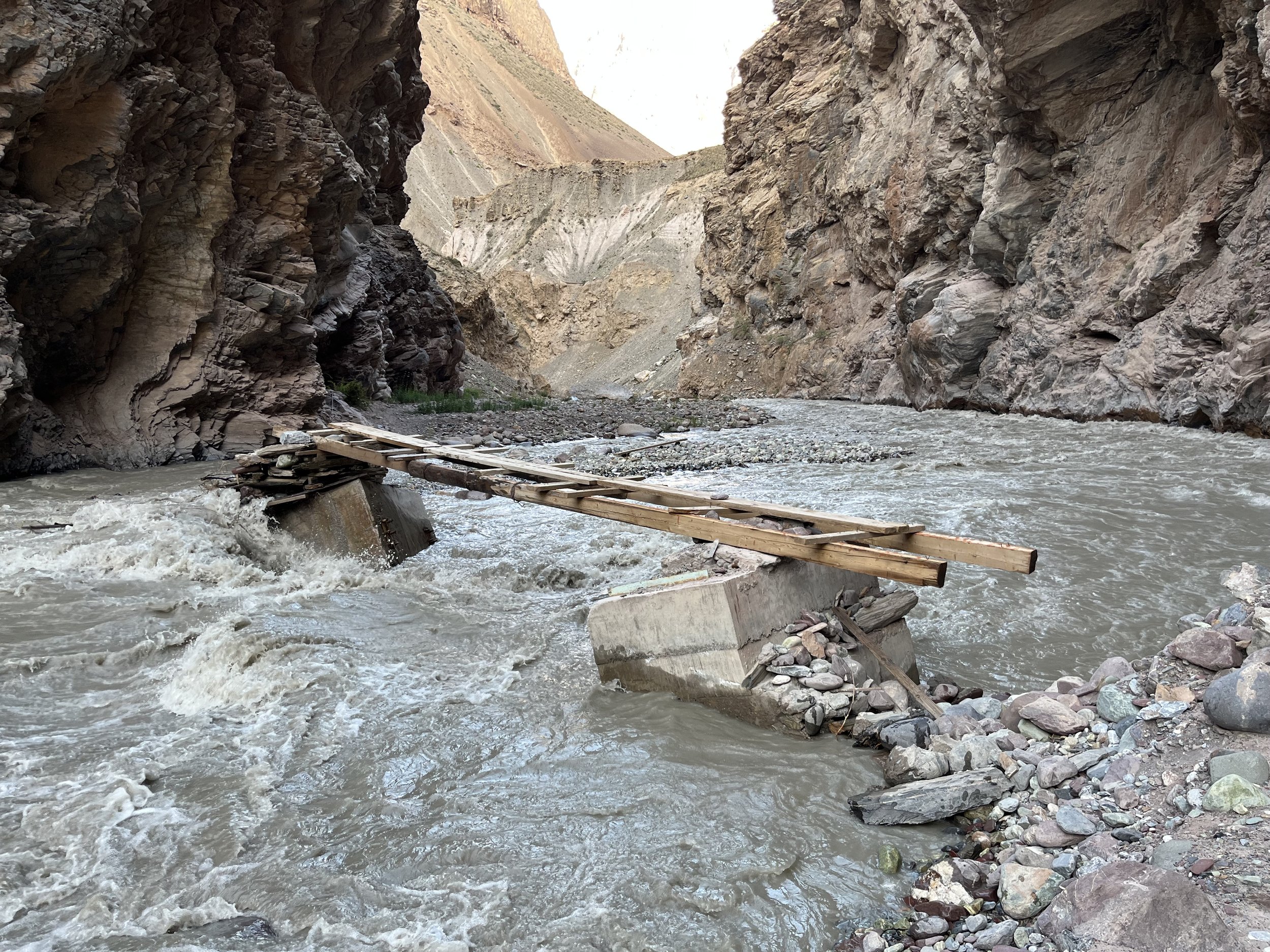
The Baju-Baghu Loop is on the right bank (northwest side) of the Bartang Valley. It does not cross the main ridge to the Yazghulom Valley, but rather returns to the Bartang after crossing two passes over secondary ridges. It is strongly recommended to do counterclockwise so that you very quickly come to what may be an impassable obstacle (the occasionally destroyed bridge over the Bajudara River, see photo below). Traveling clockwise you would arrive here on the last day. Turning back would mean a very long trip in reverse.
The Route
Using any map with Open Street Map data as its source, you can find these locations:
Start: Jizev Bridge (7km upriver from village of Baghu) —> road walk upriver to village of Siponj (17-18km) —> road walk to where the Bajudara River joins the Bartang River (5-6km) —> hike up the Bajudara Gorge to the triple confluence of the Auitsdara, Khavzumetdara and Vudor rivers (11km, 800 meters elevation gain) —> hike up the Auitsdara Gorge and camp below the glaciers (800 meters elevation gain) —> go through Auitsdara-Khodorzhivdara Pass (4510 meters elevation) and down into the upper Khodorzhivdara Gorge —> go through the Baghudara-Khodorzhivdara Pass (4380 meters elevation) and into the upper Baghudara Gorge —> go down Baghudara Gorge to the village of Baghu.
GPS Track: Download Baju-Baghu GPX
Length of trip
For my August 2023 trip, I left the area of the Jizevdara Bridge along the Bartang River at 7:00am on August 15th, and arrived downriver from this location in the village of Baghu at 12:00 noon on the 19th. However, I did a side trip up to Rosht-Zhirkutal Pass - a trip that took almost a full day. So the loop without the side trip took me 3.5 days (with some side exploring an early stops). A fast hiker could do it in three, and a more relaxed trip could be stretched to five days.
The Obstacles
A bridge over the lower Baghudara River that is sometimes destroyed by high water, some very steep and dangerous slopes above the Baghudara Gorge, and the Auitsdara-Khodorzhivdara Pass, which requires some glacier travel.
Trip Report
I camped overnight by the Jizev Bridge - on the left bank where the Jizevdara River flows into the Bartang River. The ground is flat, but hard and rocky. I needed rocks to support my trekking pole tent. A free standing tent should be fine. There is an excellent spring nearby. I had one mosquito visit from the wetlands nearby.
I left camp at 6am, crossed the footbridge and was on the road at 6:15. The road is regularly in shade at this time of day. The gorge here is very scenic with several interesting places to stop for a break or a meal. Pay attention to the rockfall hazard signs. In a couple of sections there is active small rockfall. An apricot-sized rock fell on the road near me at very high speed from high elevation.
At 9:15 I arrived at the beach just before the bridge to the village of Khijez (beach at 1:09-1:22 in the video below).
I crossed the bridge to the village of Khijez and then went up the old road on the left bank. This road is not maintained and has degraded into a single trail and a talus slope in one section. At the tiny village of Vugakhid I crossed the river again (staying on the same side would be very rough until the village of Visav and much slower). The old bridge here appears to be part of the original Soviet route up the Bartang.
After Khijez I found the Bartang Valley to be far less appealing than below. Below was a narrow gorge with cliffs, and above Khijez the valley widened and was not so attractive as earlier. In the earlier part of the day there are some cars traveling down the road with full loads of people. By 8:00am the surge of these cars stopped. By the time I got to Siponj at noon probably only 15 cars had driven down the valley, and 5 gone up the valley. The local shared cars are SsangYong Musso SUVs, Hyundai Starex minivans and the Chinese microvans the locals call “Tangems.“ These go by slowly on the rough road. But the tour company luxury SUVs and the foreign NGO luxury 4x4s (both with local drivers) go by at high speed, pass closely and spray you with rocks and dust. The only expensive car that slowed down and moved over as it passed had European plates on the car and was driven by a tourist. This is normal everywhere in Tajikistan. Drivers don’t slow down and give space to pedestrians. I get off to the side when they pass, and almost being hit by a car sideview mirror at 80km/h was a good reminder to stick to that plan.
There is not much to say about the villages. In Siponj the tiny village shops were closed at noon. The homestays there have no signs. The people were polite, but not friendly like in all the other villages in Bartang. There are petroglyphs right before the village, for which you need to call a phone number on a sign for what I assume is a paid tour on private property. But since this is not a famous petroglyph site, I passed on.
Photo below: the view of Visav from Dasht.
I had planned to buy water or something else to drink at one of the village shops in Siponj. They were closed. And from what I could se through the windows, these shops are not good resupply options. I didn’t see a village stand pipe with water either. Since the people were ignoring me, I didn’t have an easy opportunity to ask for help finding water. I kept walking. But I didn’t find any roadside springs. Basically, you will have no good springs between the spring on the opposite side of the Jizev Bridge and the spring after the Bajudara River. Right after starting my road walk I did find springs, but too soon and early in the day to refill. Any water I encountered next to the roads is from irrigation ditches, even if it appears to be a natural spring.
The first reliable water refill of the day will be in one of two locations: a very strong spring (see end of video above) a half kilometer after where you turn up the Bajudara Gorge (so, you’ll add an extra kilometer to your walk), or the spring 1km up the Bajudara Gorge. The water in these springs, like in every spring and stream you will encounter in the Bajudara Gorge is — if I am correct — iron-rich water. It is also strangely astringent. Basically, it makes the inside of your mouth feel rough and almost dry. It’s a strange feeling. The internet tells me this is probably iron sulfates. It’s harmless, just weird. The local people, shepherds and livestock seem to be doing OK with this water.
It will be about 8 hours between the good spring by the Jizev Bridge and one of these two springs above. The weather here is not too hot, and there are no real uphill sections. My water from the morning lasted, but just barely. I was definitely thirsty when I arrived at the spring. So you should carry plenty of water and maybe make an effort to get water in one of the villages. You can usually track down the owner of one of the locked village stores. If that fails, just wave an empty water bottle at someone. They’ll help you out.
I was glad to leave the road at the Bajudara Gorge. However, in this area you will first walk through a zone of river rock and gravel that is likely flooded every year. There may be a faint trail, no trail, or it may be in a different location than on the map. But you can’t get lost. You will get funneled by the narrowing gorge to where the clear trail starts. After this the trail alternates between clear/easy and steep/slippery. And in some sections the trail is regularly eaten by live scree. Then you get to the bridge, which you may or may not be able to cross. See the video below…
The video above ends with the “ovring“ sections. Ovrings are neither trails nor bridges, but rather something in between. They use a mix of wood, rocks and small gravel to attach a trail to a cliff or steep rock section. This Russian article has lots of great photos of ovrings in Tajikistan. They are unfortunately endangered as blasting car roads through cliffs has replaced the most impressive examples.
What the video above does not show are the steep high sections where you traverse dangerous scree slopes and chutes. The chutes have very vague goat trails going laterally, and a fall will likely mean death or severe injury. If you slip, you will not stop falling until you hit the gorge at the bottom (150 meters in elevation below). I think only an ice ax with an immediate super quick self-arrest could stop your fall. Later in August another group hiked down this same gorge, and their assessment was the same. The short video clip below shows one of the chutes. From my perspective and using a wide angle lens you don’t get the sense of how actually steep it is. And like all my other videos, I don’t record the most dangerous/scary sections. In those places my phone stays in my pocket. This is one of the locations where I felt more confident.
After the ovring section there is one final steep scree chute and then nothing I consider a serious obstacle for the rest of the hike (you may have a different opinion on the glacier section, see below). You should fill up on water in the gorge where the ovring bridges are. That has the most reliable stream of clear water in the area. Again, it will be iron-rich but drinkable.
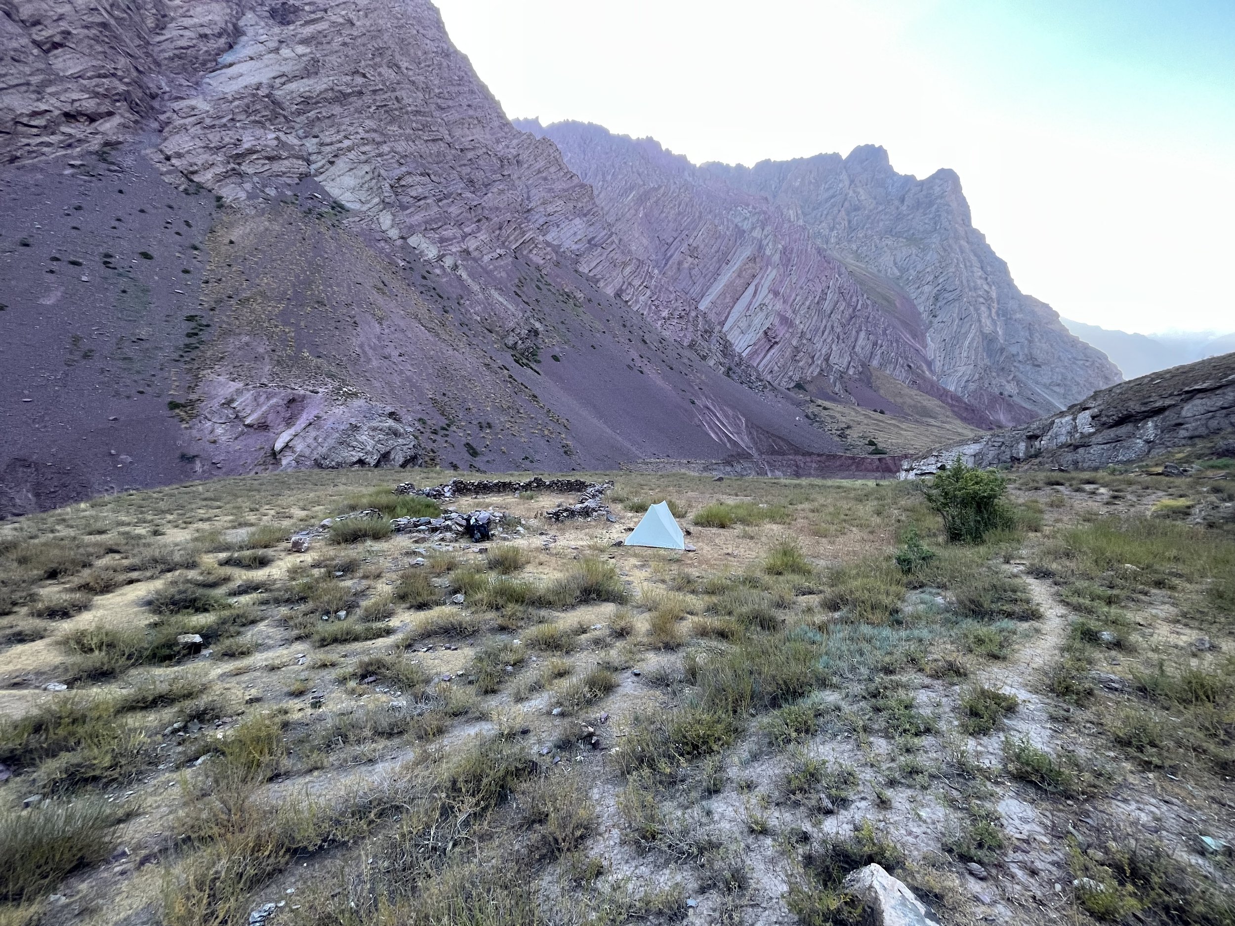
I camped at the confluence of the Bajudara River and the Radotsdara River (2535 meters elevation). The area used to have farmland and likely a house or two. It is now abandoned and there is one old rock corral that looks like it gets no more use. I camped nearby. It was flat but very hard ground. I had problems getting the stakes into the ground. Not a big problem for freestanding tents, but it causes difficulty for trekking pole tents and non-freestanding shelters.
Total time: 13 hours from Jizev Bridge to camp at 2535 meters, including many breaks and one unnecessary detour. This could easily be done in 11-12 hours.
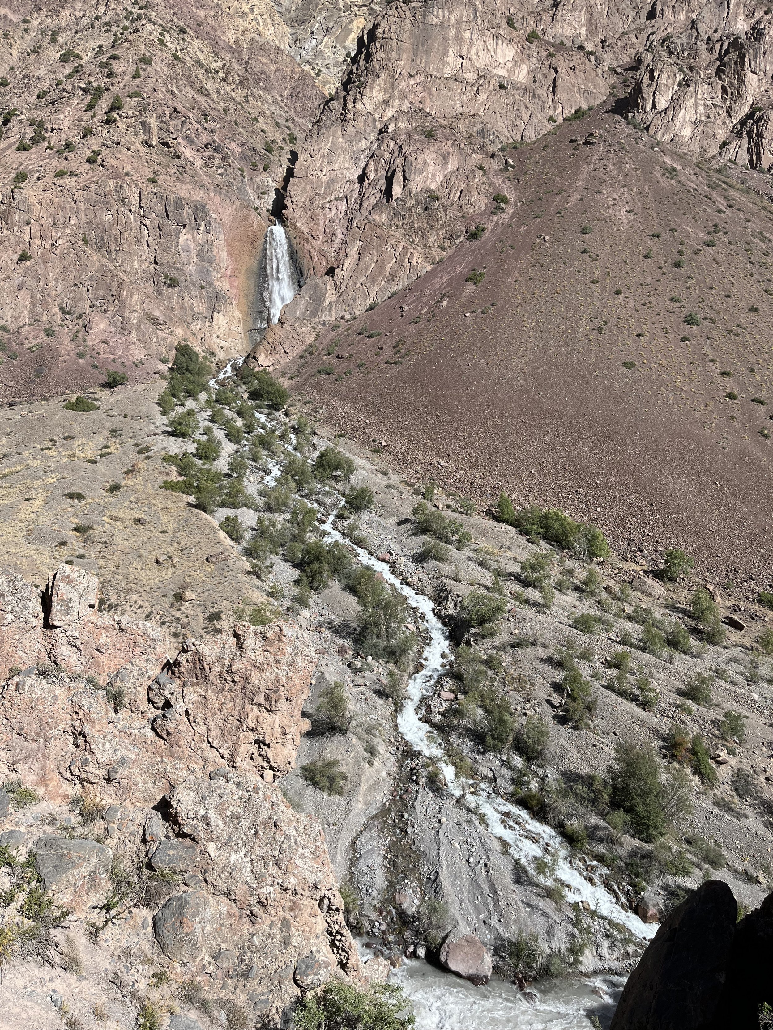
The next day I continued up the Bajudara River, quickly getting to some steep sections right next to the river. But these are far easier and safer than what I experienced the previous days. Next is the shepherd summer camp named Chivn. It was recently vacated for the season (the shepherds had moved to higher altitude following the grass), but the house still had a complete kitchen and sleeping gear, so they intend to return at sometime. By Chivn there is an amazing view of a waterfall on the opposite side of the river. I also filtered some water in the stream nearby.
From here the trail is uneventful and there is nothing worth remarking on, except that you need to be aware of there being multiple grazing tracks created by the livestock.
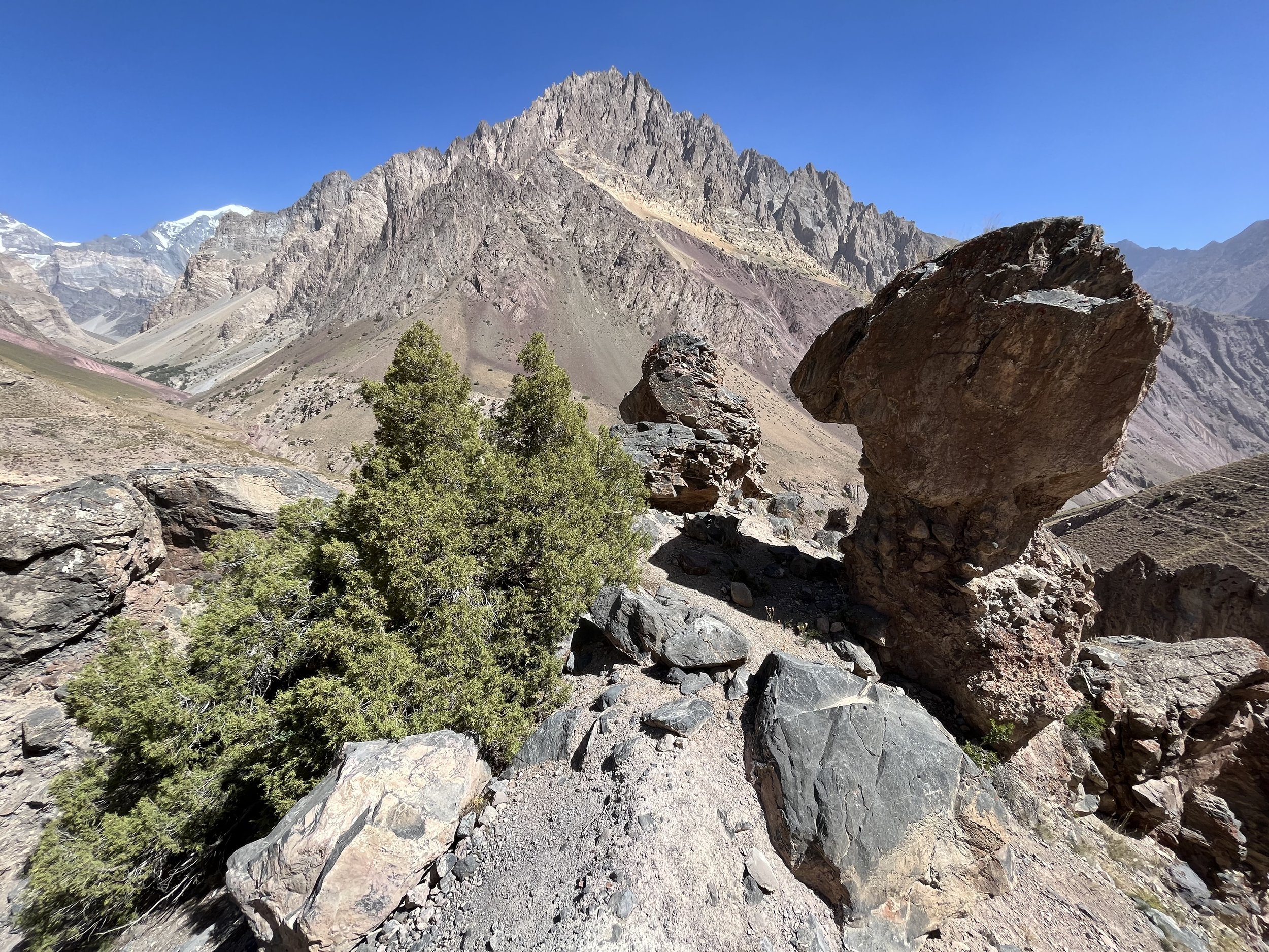
At 3000 meters elevation, just above the confluence of the Auitsdara and Khavzumetdara Rivers are some hoodoos (erosion pillars). Several of these pillars have large flat boulders as caps on top. One of them makes for a good place to sit, and there is also some shade nearby. The view here provides a look at all three upper gorges: Auitsdara, Khavzumetdara and Vudor. Across the river are house ruins and abandoned terrace agriculture fields that used to be irrigated by an ariq (small irrigation diversion channel) from the Khavzumetdara River.
Next is a small footbridge over the Auitsdara River. When I was there it spanned the main channel and then left you to navigate some above-ankle water after that. After a quick steep uphill you will come to a shepherd summer camp (3150 meters) with two shepherds huts. When I was there the sheep and goats were returning to camp on their own, but there was no sign of the shepherds or their dogs. All were farther up the mountain side out of view. My guess is that this summer camp is named “Auits,“ but there was nobody to ask. The trail in the area of the shepherd camp is very vague, and tracks head in multiple directions. Just maintain altitude and head up the gorge. The trail will again become clear.
You will likely be needing water by the time you get past the shepherd camp. The best place is from a spring right next to the river bank at 3305 meters. And then you will be looking for a spot to camp. The Auitsdara Gorge is not a friendly place for pitching a tent. Clear flat spots are non-existent or tiny, and the ground is very hard and rocky.
If your timing puts you at the shepherd camp near the end of the day, camping in that area would be a good idea. But I was there at 11:30am. At 3455 meters is a camp spot marked on the map. I was here at 2pm. It is rocky, hard and on uneven ground. I couldn’t get my trekking pole tent pitched here. I think you can manage it in a freestanding tent. But with a 2nd person in the tent I don’t see a spot flat enough to accommodate two people. I ended up stopping early for the day and cowboy camping nearby. I had good weather and clear sky, so it worked out fine.
The next morning the trail ended immediately, at 3500 meters. After this you are on open terrain and loose rock. The river is clear in the morning and you can take water.
From here my trip report falls apart as I hiked up a glacier to Rosht-Zhirkutal Pass, saw that it was impossible even with the crampons and ice ax I had, and I returned back down and camped by the glacier lake at 4360 meters below Rosht-Zhirkutal Pass. Again, I had to cowboy camp as I couldn’t get stakes in the ground or manage to stake out my tent with rocks. It was windy and my water bottles froze overnight. I only ever camp at this elevation when something goes wrong. I had intended to go through Rosht-Zhirkutal Pass and down to at least 3500 meters to camp.
Your destination is not Rosht-Zhirkutal Pass, but rather Auitsdara-Khodorzhivdara Pass (4510 meters elevation). When I woke up in the morning I traversed laterally to this pass. You will take a direct route from below. I saw the route you will do, but I did not do it myself. It is rocky open terrain of old destroyed glacial moraines and flood zones from the early season snowmelt.
When you hike up the gorge you should cross the snow bridge at 3660 meters (it covers the large spring where the Auitsdara River starts). This is where avalanche debris and snow collects, and it seems to be a permanent structure. But it was collapsed in the middle, as you can see in the photo below. You will need to decide on your own route here. It is possible to scramble around and avoid the snow bridge.
You will aim towards the intermittent stream bed to your left. It was dry in the early morning, but later in the morning it gets melt from the glacier. At 9:00am the surge of water passed me at 4000 meters heading down the stream. I would guess you have by 9:30am to get up and out of the dry stream bed (during the early season snowmelt the stream may have water at all times of day). Otherwise, follow the route marked on the map on the rocky moraine above.
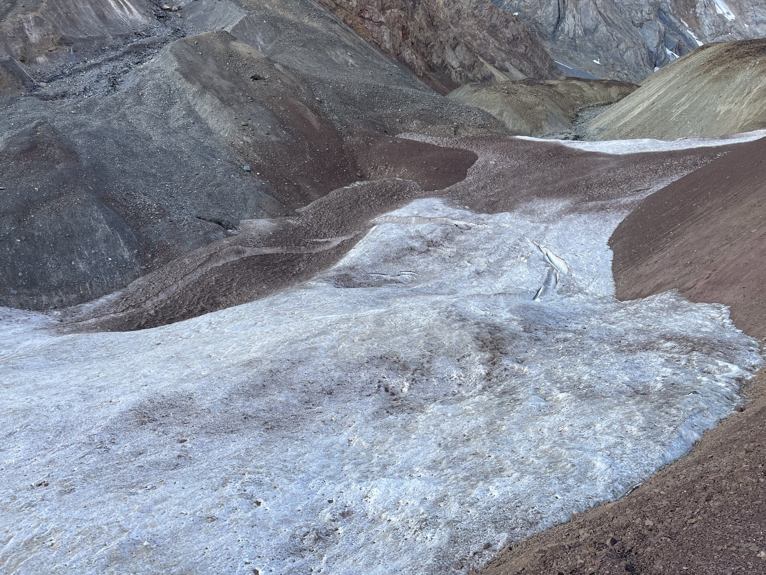
It’s all just open terrain on rocks: old moraines, rock glaciers, flood debris zones, etc. Aim for the medial moraine between the Auitsdara Glacier and the glacier that goes up to Auitsdara-Khodorzhivdara Pass. You will soon hop on the glacier. Is it the safest glacier I traveled on in Tajikistan? Yes. Are there still crevasses where you can fall in and die? Yes. There is no such thing as a safe glacier, more so “least dangerous“ than “most safe.“
The route on the map was clear and safe when I was there is August 2023. But glaciers can and do change.
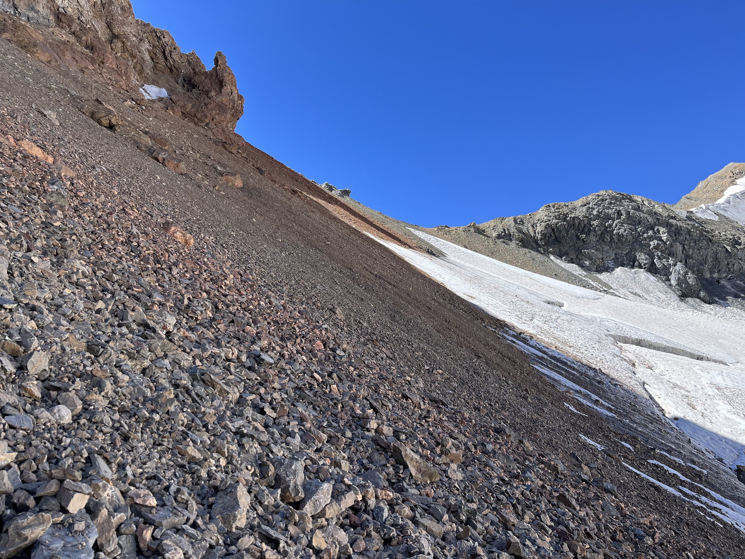
The route marked on the glacier is not at all steep. I didn’t put on my crampons. Your aim is to hop off the glacier at 4360 meters (or somewhere above) and traverse along the steep scree slope to avoid the crevasses and bergschrund that are farther up the glacier in the steep section. In this side slope section you may need crampons and an ice ax if you are here earlier in the season and the scree slope is still snow covered. But it was clear in mid-August 2023.
The lateral slope heading up to the Auitsdara-Khodorzhivdara Pass (see photo below) is steep and slow going in some areas, but never as dangerous as the steep slopes down in the Bajudara Gorge. And there was no rockfall from above. In mid-August the cliffs above are dry.
The narrated video below (zoomed out, poor quality) was taken from my hike up to the glacier lake. You won’t see this view. I call the pass “Siponj,“ which is the old and incorrect Soviet mountain climbers name for the pass. Part of my incoherent mumbling is me trying to say that you can’t go straight up/down through the saddle as the crevasses and bergschrund block your way. Towards the end of the video I say “it’s a bare open crevasse“ when I meant to say “it’s a bare open glacier.“ That means there is no snow on the ice on the lower part of the glacier - you can see everything as you walk, including the cracks and the trench melted by meltwater.
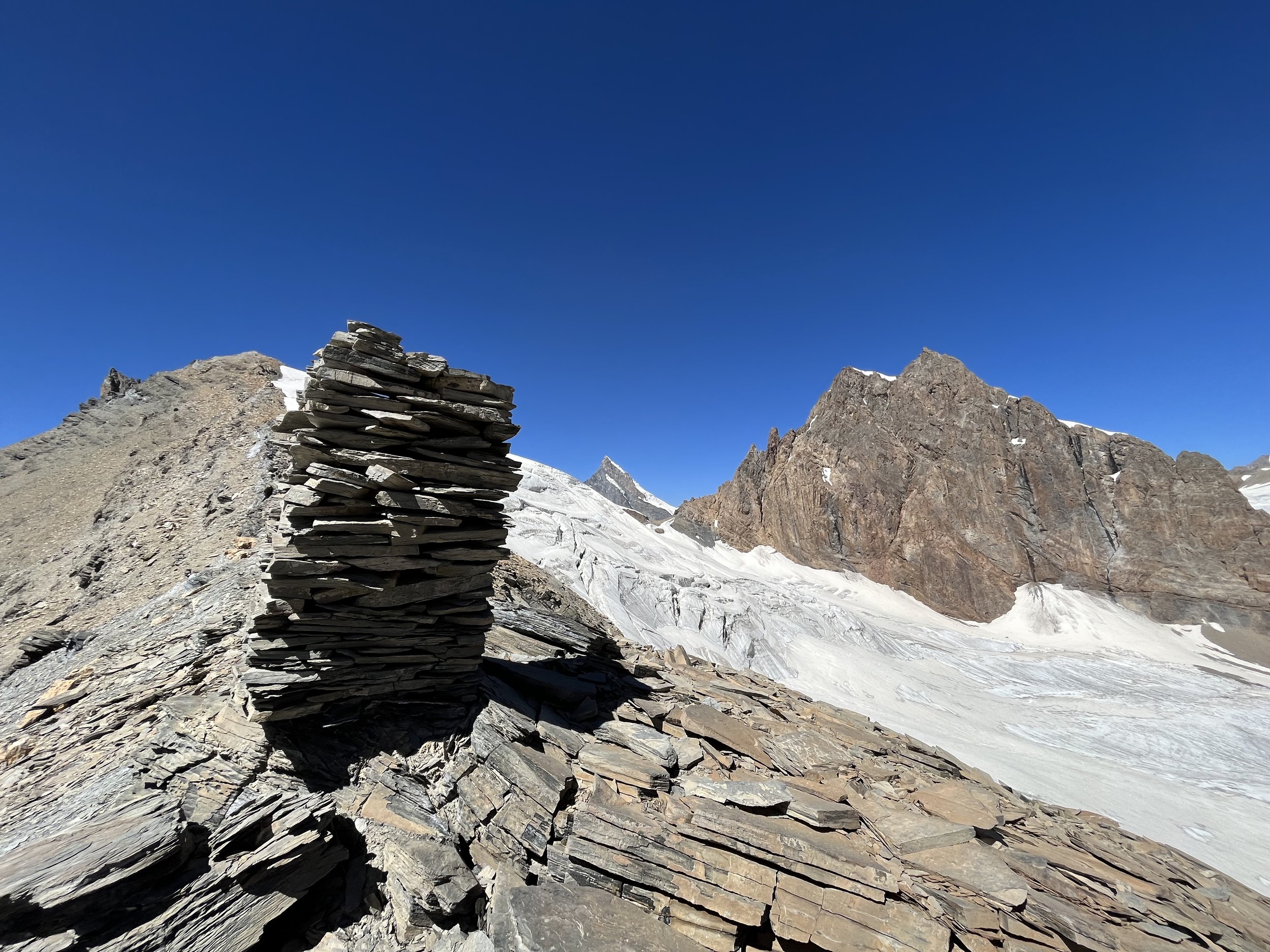
Auitsdara-Khodorzhivdara Pass is rated 1B, but it’s probably one of the easiest 1B passes in Tajikistan. The saddle offers great views, and there is an interesting cairn (photo below) about 100 meters up the saddle. The good news is that you are finished with the difficult sections. Between here and the village of Baghu the terrain will be safer and easier.
From here, look at the ridge to the southeast that separates you from the Baghudara Gorge. The closest obvious saddle is “Upper Baghu Pass,“ a pass badly misnamed by Soviet mountain climbers. It may be only labelled in Russian on your map (“Багу Верхн.“). This 4430 meter pass seems to be the most obvious pass. It is the closest and you can hike laterally without losing much elevation. I went through this pass, and that was a mistake. Its difficulty rating was incorrectly categorized - a common occurrence with 1960s and 1970s climbers trying to impress people by giving easy rating to hard passes. They rated it a 1A, but on the opposite side there is a steep rocky couloir that I had to down-climb. It was not safe. There was loose rock and potential falls of 10-30 meters if you slip or lose your grop. So I changed the rating online to a 1B.
Do not use this pass, instead descend over open terrain into the upper bowl of the Khodorzhivdara Gorge. You will be aiming for the Baghudara-Khodorzhivdara Pass (4380 meters). If you need to camp for the night, there is a flat section below the pass to the east (between 4200 and 4250 meters), and you will pass by two springs on your way there.
I did not go through Baghudara-Khodorzhivdara Pass, but I was able to see the saddle at a distance from both sides, and it seems to be a wide open scree saddle with gentle slopes on both sides. Your approach hike may be different than what is on the map. On the west side of the pass you cannot descend directly to the Baghudara Gorge. The side gorge narrows and deepens and is eventually impassable. So after a direct descent to about 4200 meters, you will need to angle to the north up the Baghudara Gorge. That slope is wide open and you can find a route there (the route may be slightly different from what is marked on the map).
At about 4050 meters elevation you have a decision to make: continue up the gorge to the lake at 4200 meters, or drop down to the gorge to cross the snow bridge and make your way down the Baghudara Gorge. And if you are going down the gorge, do you see the seasonal snow bridge? It was there in mid-August, but it will be gone by the end of the month (it will vary from year to year). If the snow bridge is gone, do you feel comfortable crossing the small river? If not, you need to continue up the gorge and detour around the springs where the river starts.
If you want to go to the lake, it’s a nice but not particularly spectacular location, and it offers the first really good camping spots (in terms of flatness and ease of staking a tent). On the way here you will occasionally see ibex grazing tracks, but there is no clear trail.
The descent down the Baghudara Gorge will be much less eventful than the ascent of the Bajudara Gorge. Going down from the lake you will be on open terrain with an occasional grazing track. If you choose to immediately head towards the right bank of the stream, you will pass by an interesting spring that is very fast and large (at 4015 meters).
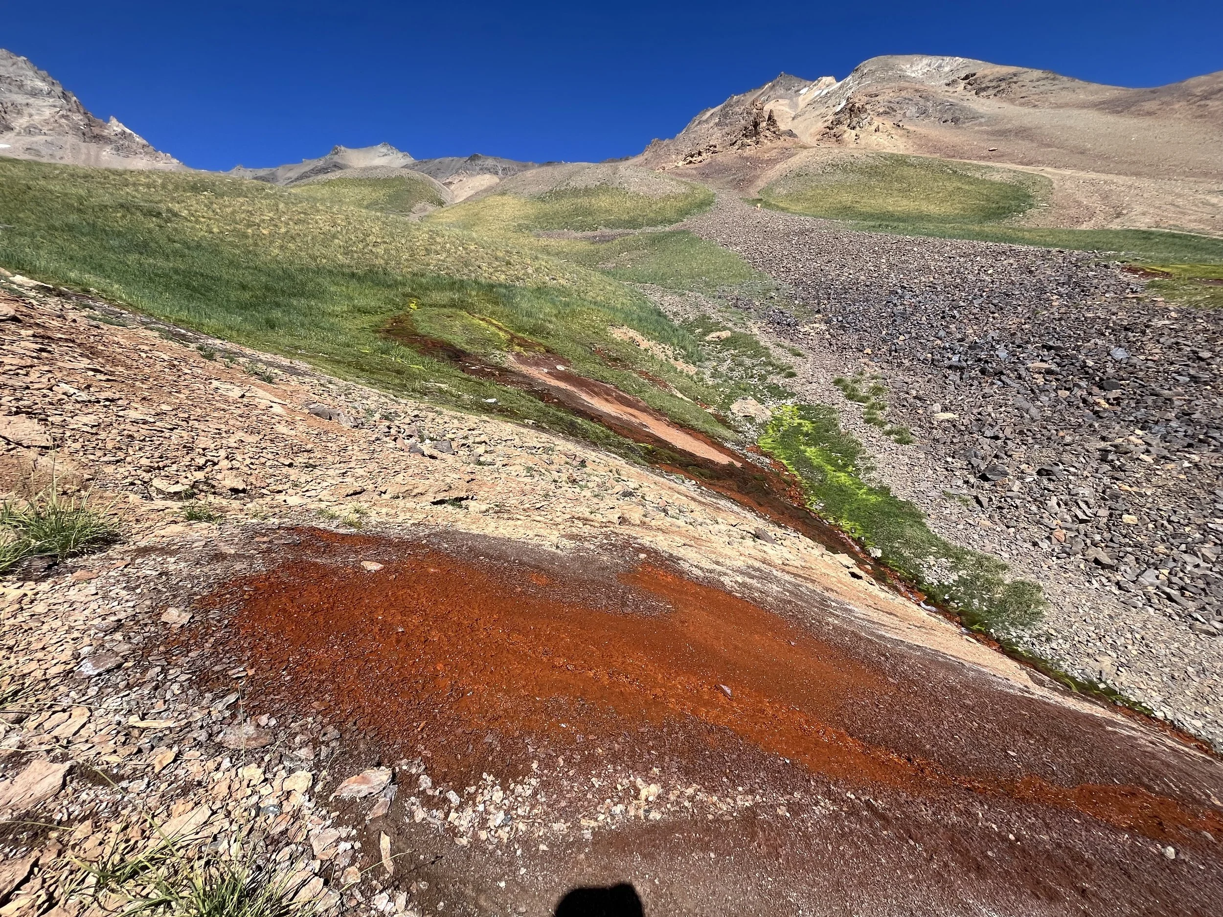
That route will however be on steep and loose slopes in some sections. An easier route would be to go around the east side of the three tributary streams. Before getting to the snow bridge (or the small river crossing) you will pass by several iron-rich springs at about 3980 meters elevation. The water itself is not red, but the area is coated with red oxidized iron.
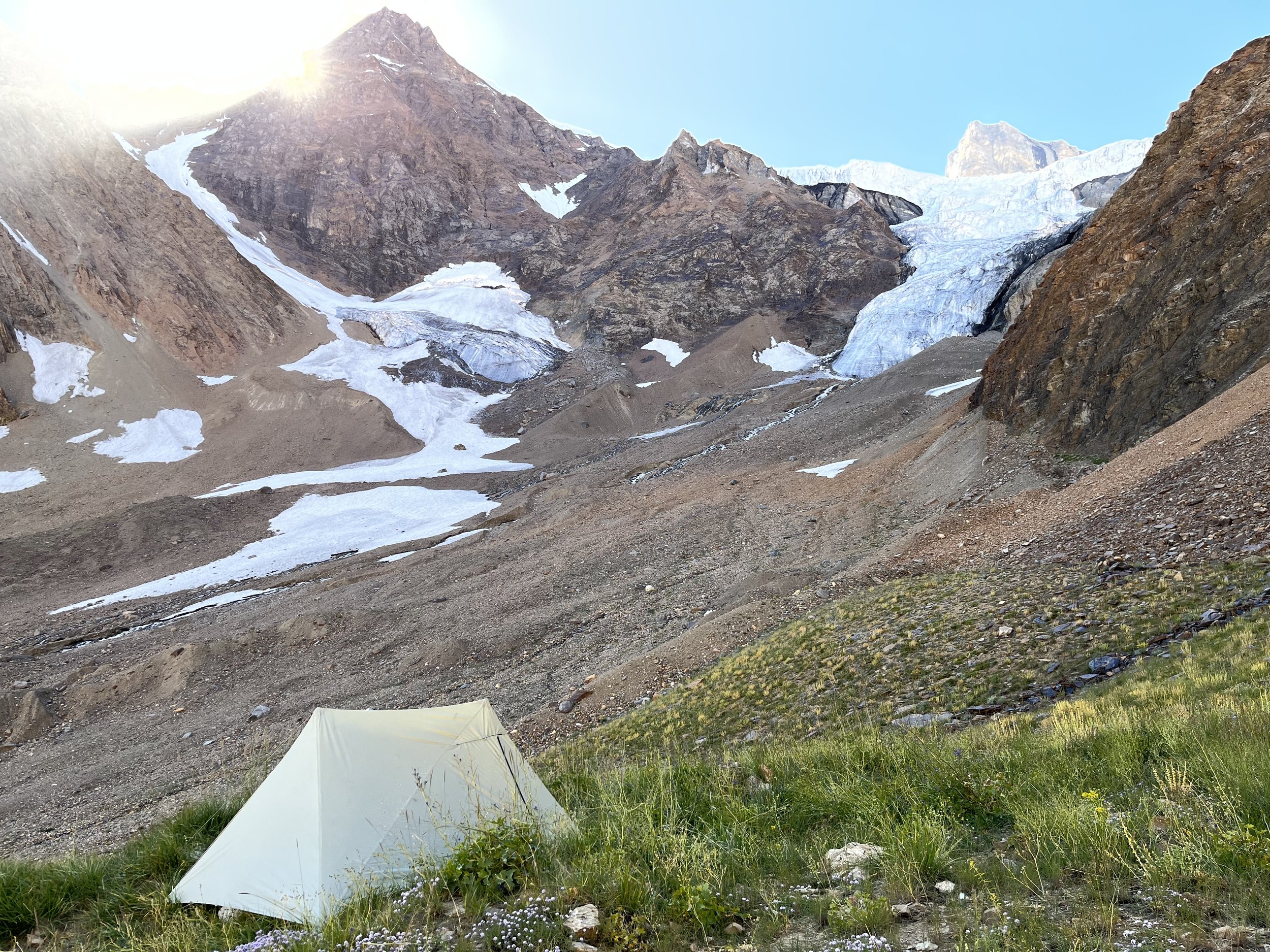
Once you cross the snow bridge (or river ford) at 3925 meters elevation you will soon be on talus of various sizes. The rocks are not very loose and are easy to walk on. At about 3870 meters the talus ends and a mixed dirt and vegetation slope begins. It is steep in some areas and will slow you down. You will again briefly go through some talus before you get to the 3775 meter camp and icefall viewpoint. It was a camp with a great viewpoint, but you will only have enough space for one person, not two people in a tent. It is very uneven and there is no real flat area.
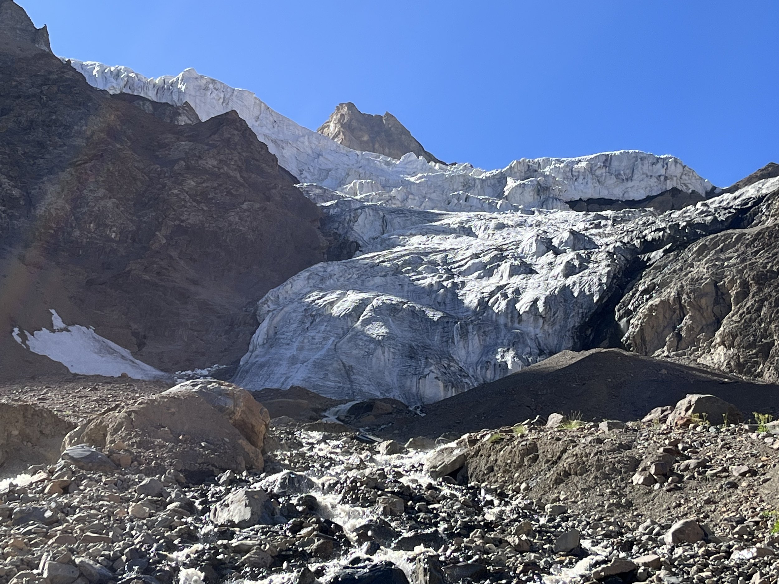
I spent some time exploring in this area. Getting close to the icefall is quite interesting, but be aware that ice does sometimes fall off the icefall and hit areas you thought would be safe.
A better camping option nearby is next to the 3750 meter viewpoint. The area is flatter and softer, but still sort of lumpy. To get here you will have to go down and then back up. In between you will cross several streams. The stream that comes directly from the icefall is silty, especially later in the day. But the other two were clear when I was there and were fine for drinking.
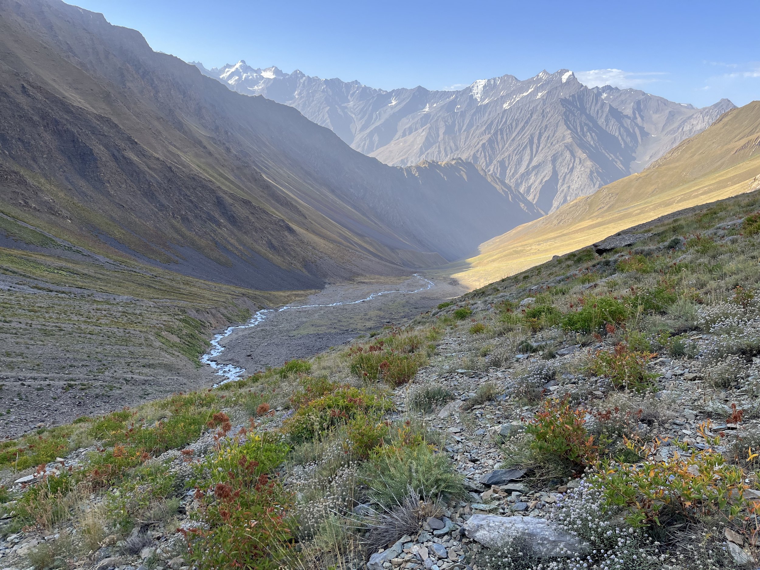
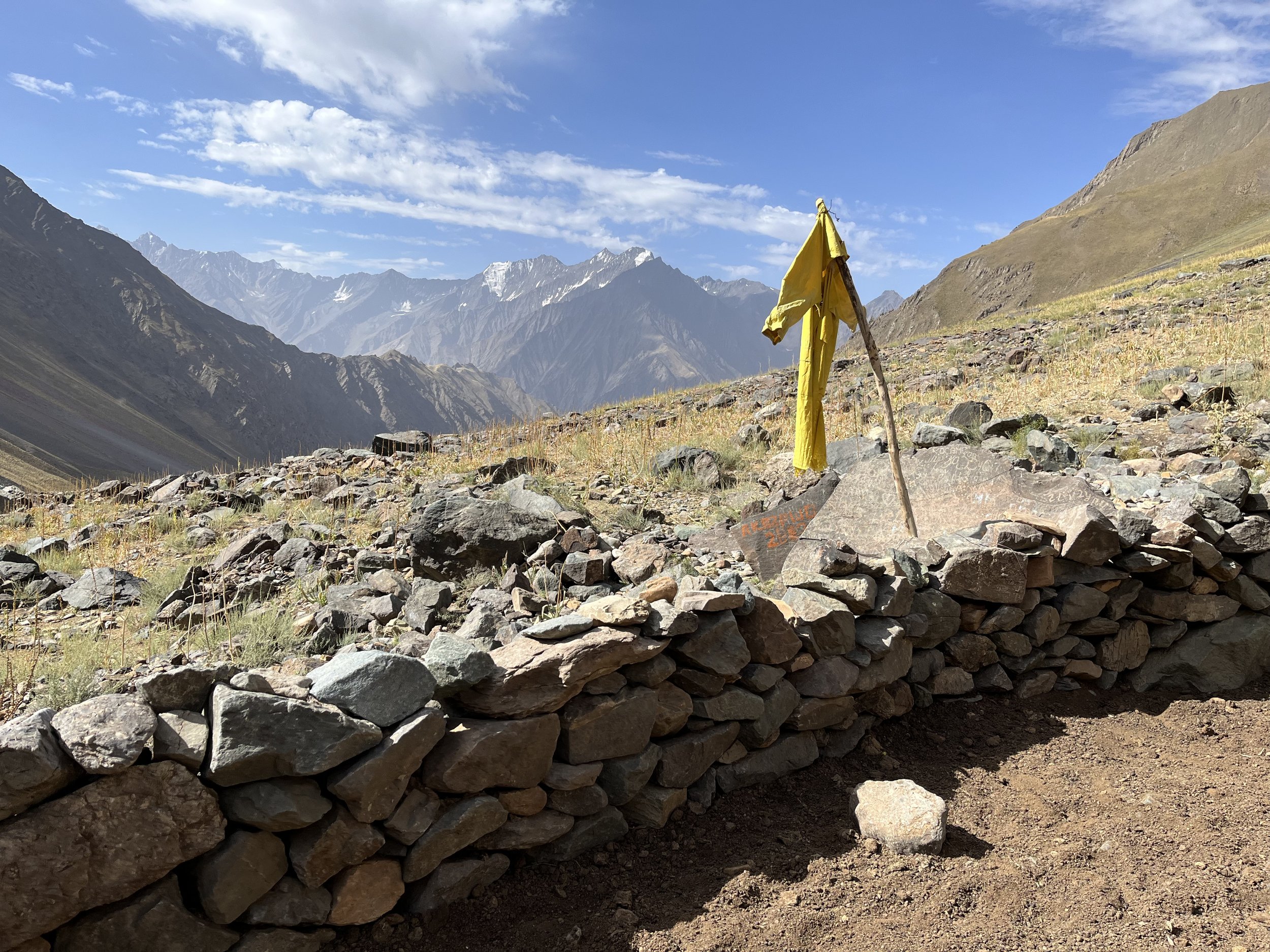
Below this the grazing area starts, and I came across a herd of bulls immediately. The sheep, goats and shepherds had left the upper gorge and returned to the lower valley by mid-August and the bulls were left to graze on their own. You will now see grazing tracks everywhere. Sometimes there is a trail going down the gorge, but you will also be on trails that go laterally without losing elevation. You will eventually need to leave these trails and go straight down, often crossing trails as you descend. You can choose your own route until you get to the Vovnifir summer camp at 3115 meters elevation (abandoned by mid-August). After this there is one main trail that you should stick to. The area near this summer camp is flat and you can camp here, but sometime before mid-August there will still be livestock, shepherds and dogs here. You will be welcome, but you may not want to sleep at a camp. The clothing on sticks (photos below) are scarecrows to keep snow leopards away from the Vovnifir corral. The photo on the top left (first on mobile) is a view of Vovnifir from above.
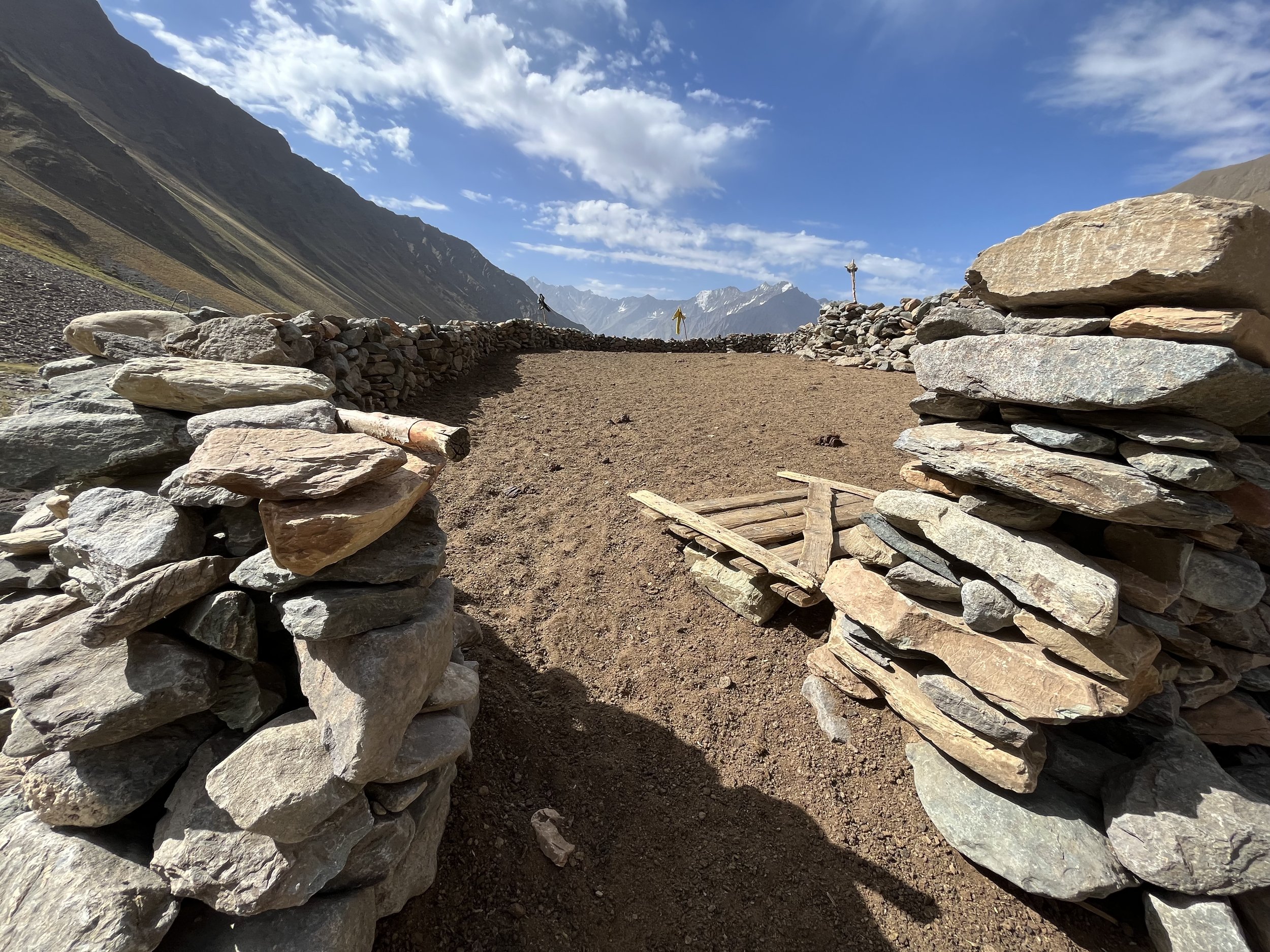
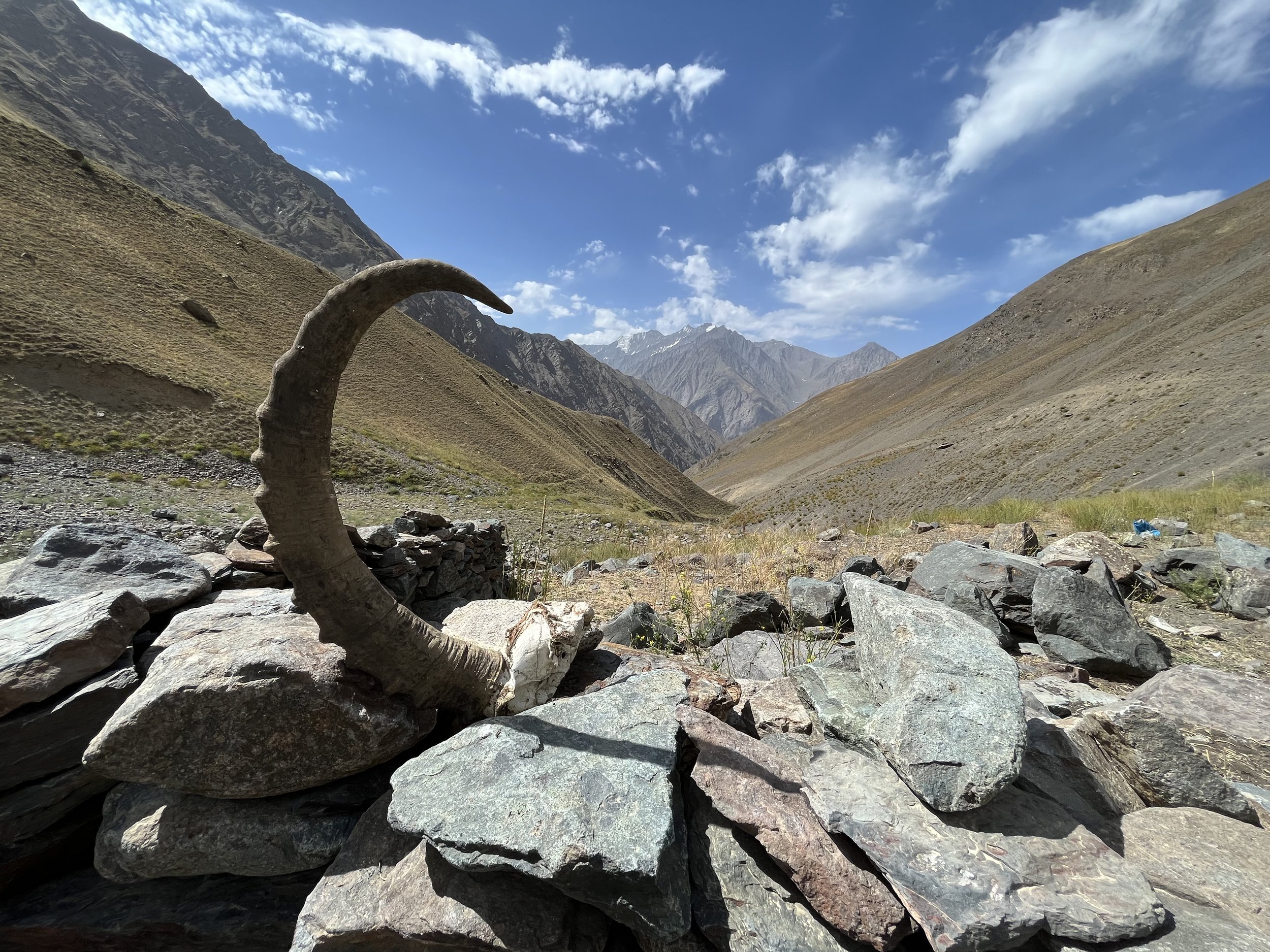
The stream right below the shepherd camp is clear water, but should be filtered as you are now in an intensive livestock grazing area. At 2925 meters there is a good spring to get water straight without filtering. There are other good springs at 2855 meters and 2465 meters, plus the Shuvdidara stream was clear and silt free midday in mid-August when I was here.
The route below Vovnifir does have a few sections where the trail is not very clear, and there are a few short sections with steep scree slopes and chutes, but nothing like what you experienced in Bajudara.
Baghu has a homestay on the map, as does the village of Emts (I can’t confirm that either actually exist). If you are doing a road walk to the town of Rushon, there is a great spring before Emts right next to the road, and Shujand has village shops that stay open most of the day. In Rushon you have options for accommodation and resupply, as well as onward transportation.
The video below is a full non-narrated video of the entire trip:
