Section #5: Dashti Ghurk to Mullokoni
Distance: 42km, 26 miles. Elevation: 1815 meters up (1400 meters at Khingov River to 3215 meter pass), 1615 meters down to Mullokoni.
Food and resupplying: Before leaving Dashti Ghurk, you need to think about your food supplies. In Mullokoni in 2023 there was a small village shop. I passed through early in the morning and it was not open, so I don’t know what selection of food they have (as usual, there was a name and phone number to contact the manager posted on the door). Also, small village shops go out of business, new ones open in a different location, or a shop isn’t open when you pass through. There is no guarantee. If the shop here is closed, just sit outside the store and act sad. A local will eventually assist you and call the shopkeeper or send a boy to notify him that he has a customer waiting.
If you are worried about resupplying in Mullokoni, your strategy could be to carry enough food from Dashti Ghurk to get 100km all the way to the the town of Tavildara for the next resupply. Or if you can take your chance with the one village shop in Mullokoni and if the shop is closed or doesn’t have a good food selection, you can start walking and hitchhiking down to the village of Shaydon where there are several shops, and then hitchhike back up to Mullokoni. You might get lucky immediately, or you might be walking for a very long time before getting a ride. Cars are rare here.
The route: The route on the GPS track is not the route I took in 2023 (mine was different in the middle as I chose Archatuk Pass to the north). The route I hiked has very little water and lots of “sidehilling“ - lateral hiking on steep slippery slopes (very unpleasant and tiring). The GPS track route provided here is a shepherd route. The entire route will be grazed by sheep and goats. In some areas this means that there will be multiple tracks, or sometimes no clear trail at all - just an open grassy slope.
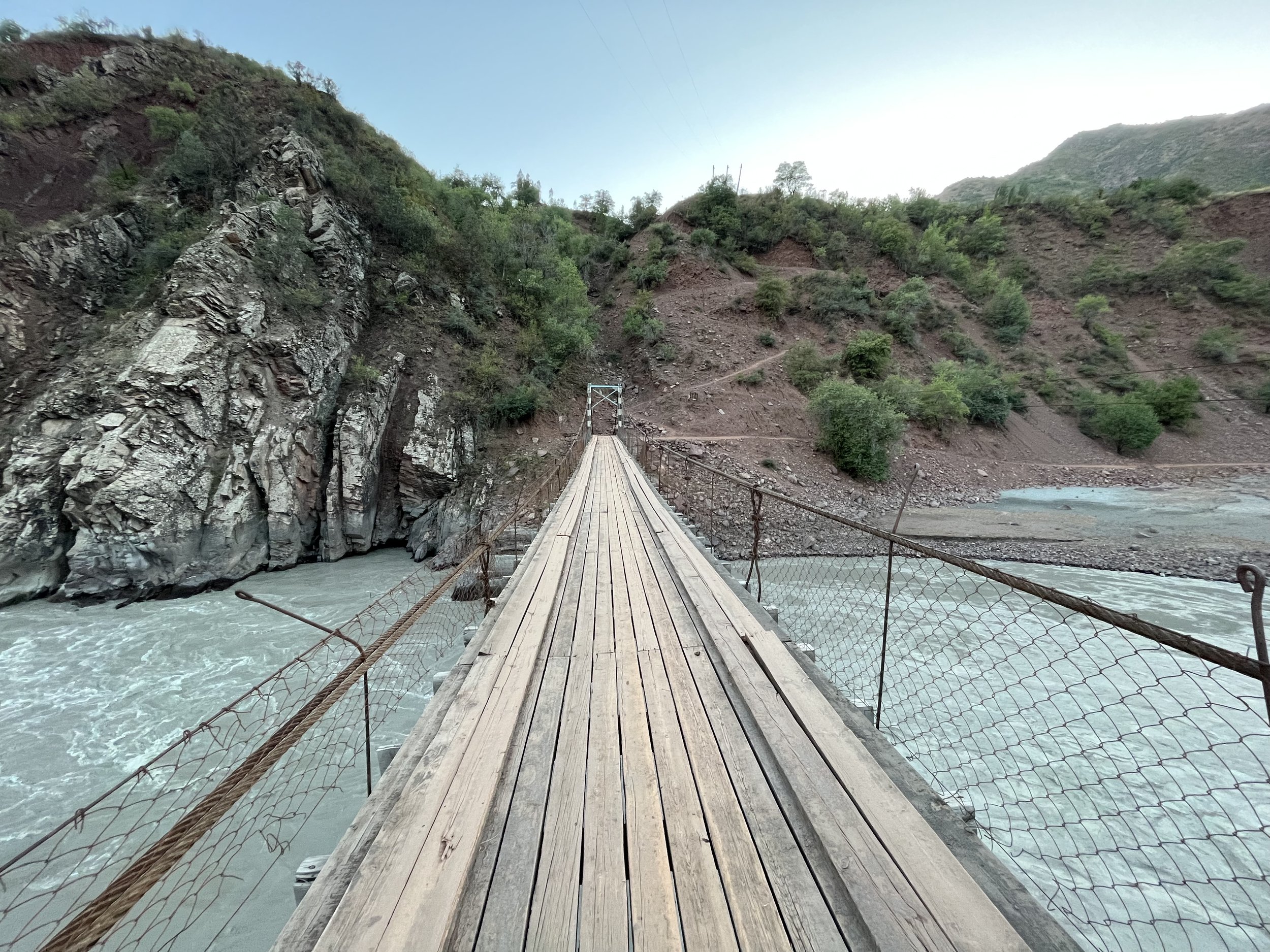
Photo below: the bridge over the Khingov River between the villages of Dashti Ghurk and Norinj.
Water strategy: There are no guarantees with water. You may want to do some heavy water carries to be safe - starting with how much water you take with you from Dashti Ghurk. The next water source, aside from the village of Norinj, is a spring at 1865 meters (you’ll find it in a wooden cage to protect it from livestock). Just around the corner farther uphill I crossed a couple of small streams, but the spring water will be way better. At 2050 meters is a shepherd camp named Bedak. The shepherds here tell me they stay in this spot into October, and that there is a good water source just downhill from their camp. I didn’t visit it, so I don’t know how far downhill it is. But it’s close enough for them to go there daily to fetch water.
The next water source is unclear, as the route I hiked diverges from the suggested route at the 2680 meter pass. At the 2680 meter pass I continued laterally on the slope, going by some very tiny and unreliable water sources that looked soon to be dry. But the GPS track provided here will drop down in elevation to the basin. Here, in what is now grassland, I could see several narrow strips of trees in shallow gorges. This means there is water there - but not necessarily available on the surface. You may want to explore - the top of these green tree strips is where the water will likely be if there is any still running. If not, you will need to continue on up a gorge and eventually drop down to the stream to fill up on water (quality unknown). The bad news is that it is a 200 meter drop down, and then back up. If there is no water here and you are running low on reserves, you have to go back the way you came (and your trip is over). I can see water in this creek on every satellite image I can find - but with no indication of year and date.
When heading up to the 3215 meter pass from the last water source, you will need enough water to make it to 1915 meters elevation on the other side when you cross a small stream (4.5 liters is a safe amount, 6 liters or more if you are a heavy person or if it is really hot). There is a spring next to the trail at 3160 meters on the west side of the pass, but it was a weak trickle when I was in early September.
All of these water worries can be overcome with the ability to carry a heavy load of water and to be here later in September, rather than early September. Temperatures drop steadily through September.
I had no problems, as I was able to find tiny trickles and small springs. But these may not be there for you in drier years or later in the season.
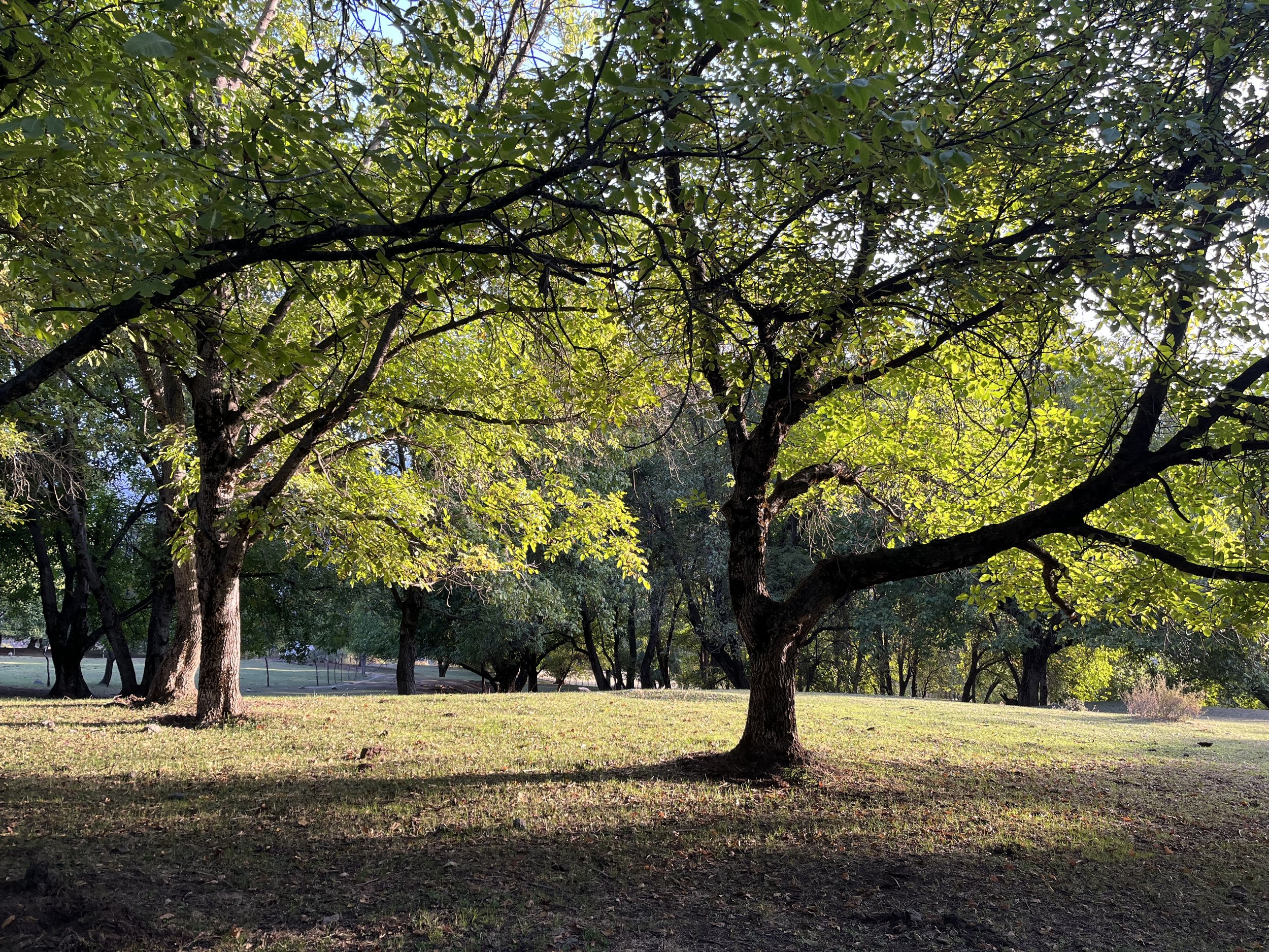
Photo below: walnut orchards above the village of Norinj.
Random info: the west side of the pass has a slope filled with sinkholes. Some of them have ponds full of undrinkable water. A few of them look like you wouldn’t be able to get out if you fall in. Be careful.
The orchard above Norinj would make for a great camping spot. I’m sure the villagers would be OK with you camping here as long as you are not camping near the walnut-harvesting women and girls during the walnut harvesting season (in October).
Above the Bedak shepherd camp there are no more wild fruit trees, only juniper and maple.
At 2400 meters is when you start to come across multiple random trails going different places (or to the same place by a different route). You may need to check your position on GPS occasionally after this point.
It was clear that by the first week of September, the majority of shepherds and flocks had left this area. I saw three flocks, but only in lower areas. I only walked by one active shepherd camp.
I saw bear scat on the east side (but only as high as the fruit trees grow) and wolf tracks on the west side grasslands. I saw sign of wild pig activity (digging for roots). Once down at the bottom on the west side you will also need to consider cobra snakes. Bears, wolves, wild pigs and cobras. All at once. Stay out of the high grass and brush at the lower elevations to avoid a snake encounter.
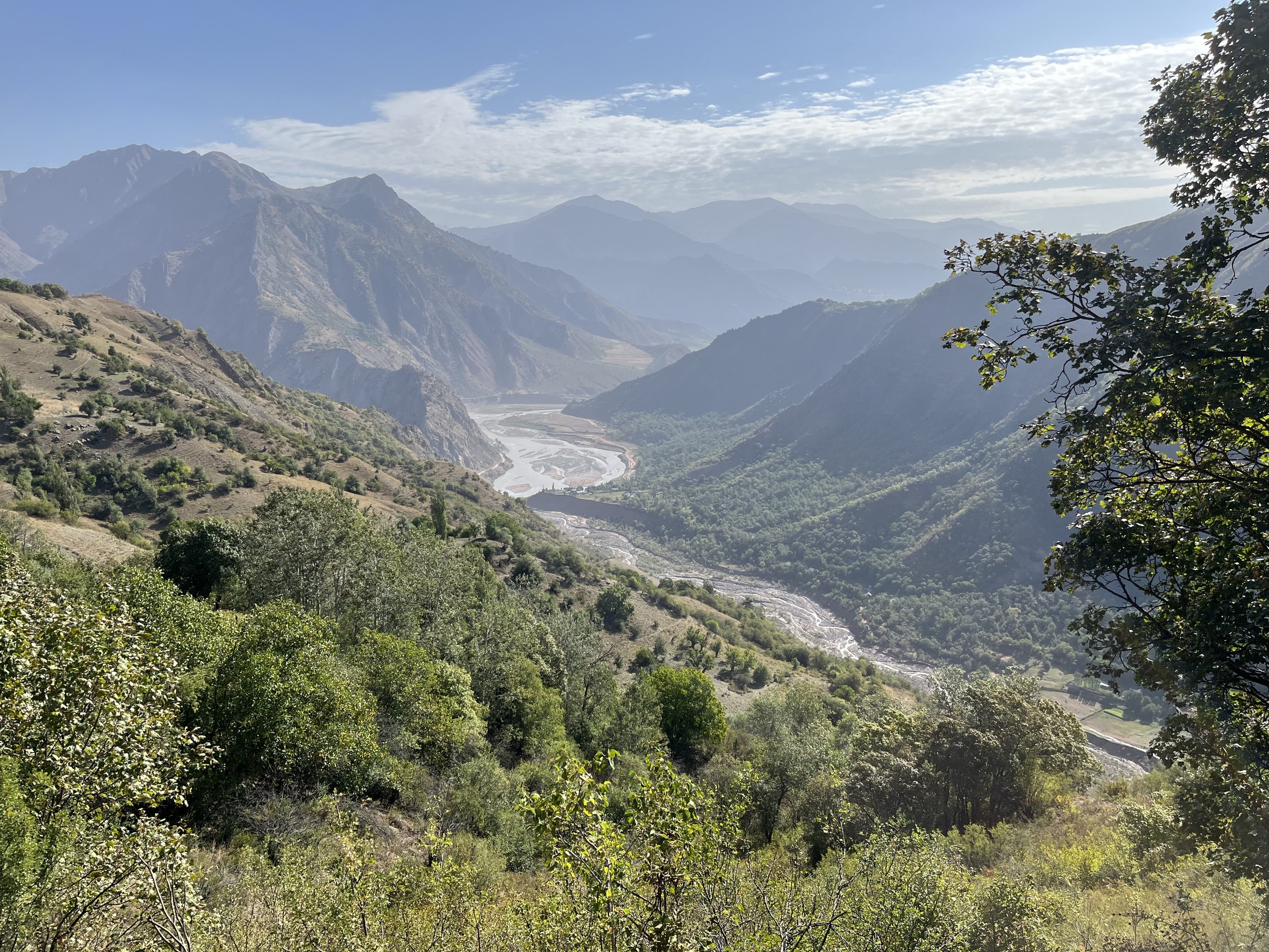
Photo below: entering the Sari Khosor Natural Park.

Alternate side trip: if you have the extra time, the side trip up the Shingidara gorge and through the village of Tutkoni is nice. The people here are very friendly, as they don’t see any tourists as the locals in Mullokoni do. There is a huge tree to visit, and some interesting geography (photo below). This short side trip is especially recommended if you are too early in the day to arrive in Mullokoni (where the shop won’t likely be open until well after lunch). The GPX file includes this alternate route.
Section #6: Mullokoni to Tavildara
As described above, you need to resupply in the village of Mullokoni if you don’t want to do a very long food carry from Dashti Ghurk. Water notes are in the GPX file. I did not find a working public water stand-pipe in Mullokoni, but I was only on the main road. I’m sure it’s there somewhere. If not, you can soon get water from the small side stream that comes from the waterfall. The main river is saltwater. It’s not very high salt content, but don’t try to drink it (until you are above the confluence with the Shurob River).
You’ll notice on the map that there is a a small hotel, then a resort and hotel right after Mullokoni. The first one has never been open in the five times I’ve passed by. In 2023 there was zero sign of any life here (locked gate, no cars). The resort and hotel after this is a strange place. The waterfall here used to be a free public place. Now it has been privatized and gated by the resort for guests only. The water has been mostly diverted to a power generator for the hotel. The hotel was built because of the beautiful waterfall. But the waterfall is now a shadow of its former self because its water was diverted to provide electricity for the hotel which was built because there was a nice waterfall, but which is no longer nice because the water has been diverted. I attempted a visit in 2021 despite this, but was immediately turned away by a state security officer who informed me that foreign guests are not welcome without a document of permission from the State Security Committee in Dushanbe (an impossible task). In 2023 the hotel had zero guests on a weekend day in the prime visiting season for this area. So, it’s basically a private resort for high-ranking government officials who rarely visit, from what I can tell (it was on Booking.com years ago, but has now been removed).
So if you thought that you had a chance to charge your batteries and have a shower and clean bed in this area, you do not. However, this is Tajikistan. A possible (but statistically unlikely) scenario is that an “important person” sees you on the road and escorts you into the resort. You are now his guest and the security officers obey him. Or, slightly more likely, the rules and/or management change completely - or just day to day - and an employee gladly sells you a room for the night. But don’t count on it. The security officer I encountered did not want me there, whether as a paying guest or not.
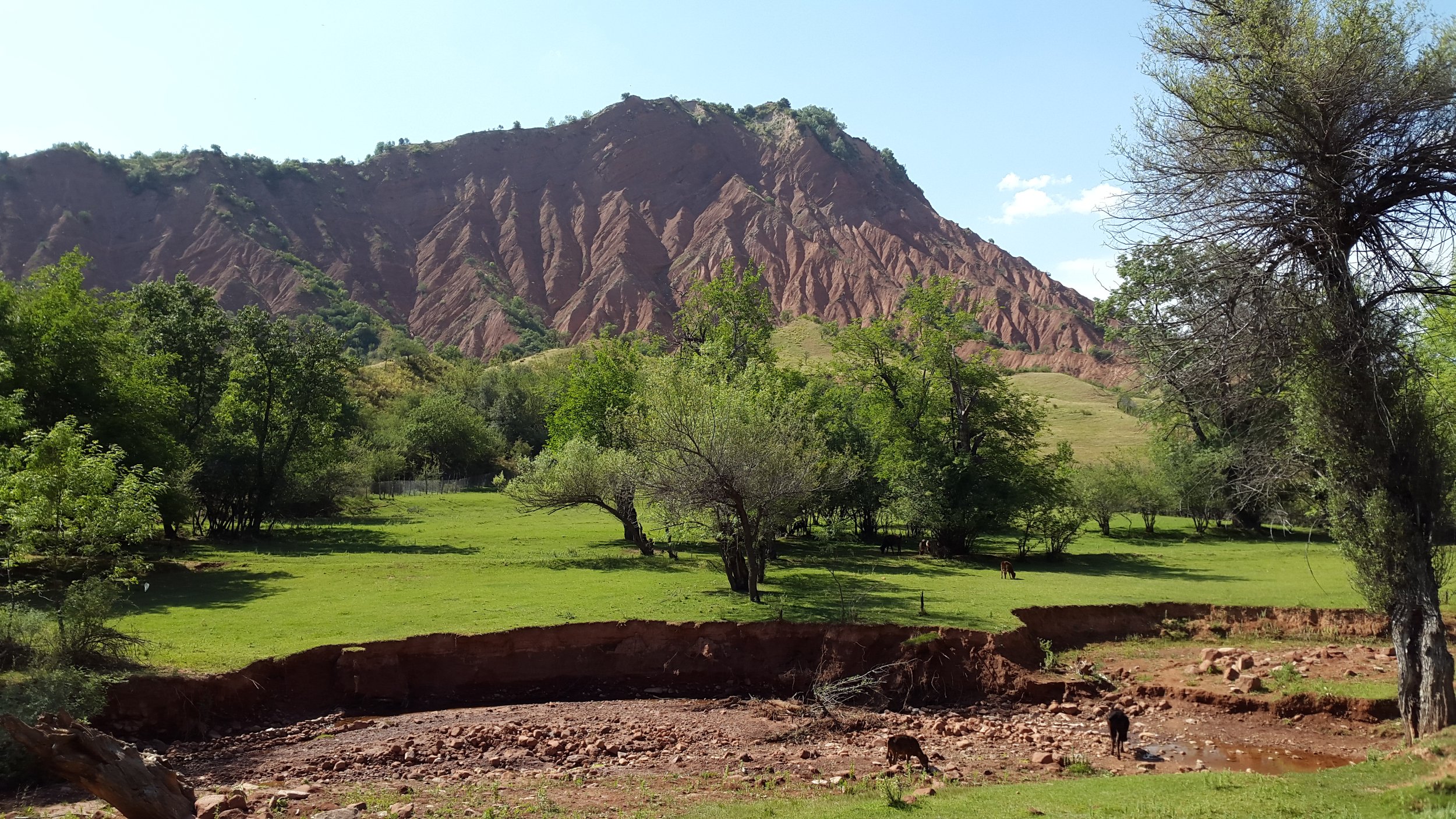
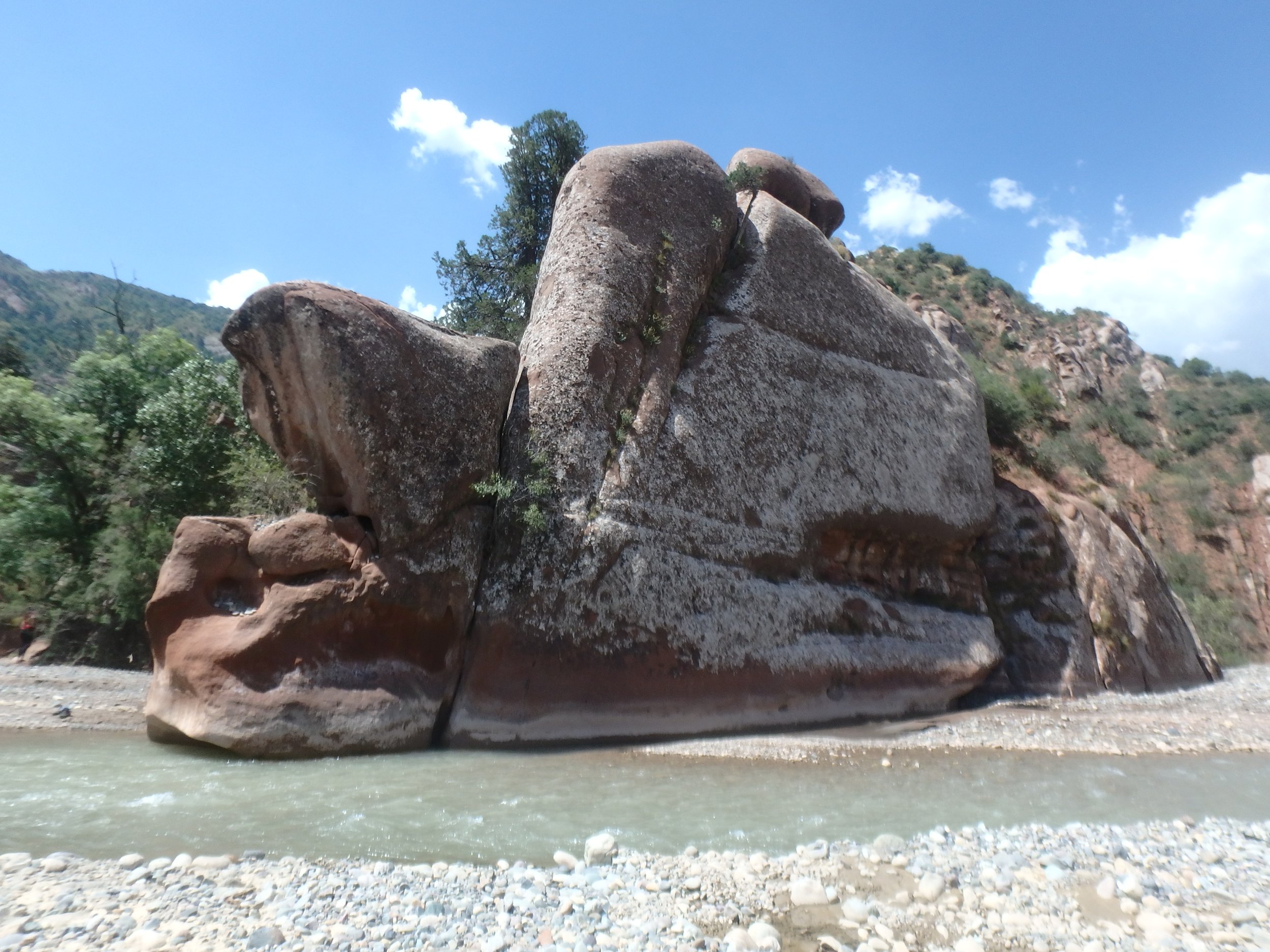
After Mullokoni you are walking on a “road“ - basically a double-track that is created anew every year according to spring floods changing the river course and moving around rocks. So the GPS track may be inaccurate. But it’s super simple - make your way up the valley in the river bed. The river won’t be an obstacle in the fall. There is some nice scenery in the area (image below).
From Mullokoni until Tavildara is not difficult terrain. But water sources will be unpredictable because the new route I’ve drawn manually cover areas I’ve only day hiked (with a car full of food and water waiting nearby). I have’t made a complete list of springs and collected info on stream water quality. And there are some shorter connecting sections I have not been on. But I was right next to these sections and locals and shepherds assured me that there is an easy trail farther on all the way to the planned destinations. But you never know, sometimes locals are wrong, or I misunderstood. So I’ve confirmed the routes via satellite imagery and added them to OSM map data.
The town of Tavildara is a regional center and has both grocery stores and two hotels (no recent info on an old homestay that is marked on the map). I was here in 2022 to do some food shopping and have lunch, and I was able to get what I needed. This is stopping point for overlanders in the cars and cross-Eurasia cyclists.
You will not be the first tourist people in Tavildara see. You may get document checked by the road police outside of town. If anybody asks where your GBAO permit is, you don’t need it. Only those going over the road pass to Qalai Khumb and the rest of the Pamir Highway need it. I was however briefly interrogated in a convenience store by what I thought was a security committee officer. After an unpleasant conversation I went to a local tea house and had a very pleasant conversation with the highest ranking police officer in the district -experiences with police and security officers can vary drastically. Later that night I was a guest in the house of a local who was then told about the convenience store interrogation. He made a quick phone call (I assume to the store owner) and found out that it was in fact a low-ranking municipal government employee who interrogated me. He offered to summon this man to his house and beat him in front of us. We thanked him but declined the offer.
Next section: Tavildara to Hazrati Sulton