
Section #10: Hazrati Sulton to Sari Khosor
Sari Khosor is the well-known name of the area you are headed into. You were already in the upper parts of Sari Khosor by Mullokoni. The name of the village this section ends in is Shaydon, but it is also referred to as the “center“ for Sari Khosor, and some may call the village itself Sari Khosor. You can plan to resupply in Shaydon, or just to buy some snacks and fruit in the small stores there. One day later you could be all the way to Baljuvon, with much more food shopping options.
The route to Shaydon is easy. I’ve done it multiple times. However, I was generally not worrying about water as I was with local friends. You will be on dry ridges, then in a dried river bed. I can’t remember where water was running, or if we got water from a local farmer or spring around the halfway point. I’ve driven it recently, but my last walk was more than 10 years ago.
To be safe, count on the route to be dry of water until the village of Dashtarho. But that’s 32km. The terrain is fast, and it’s possible in the cooler fall to make that distance in easy terrain with an amount of water that you can carry. Don’t trust satellite imagery showing running water. There is no guarantee that there will be water when you get there. So it’s a heavy water carry until I visit again to make water notes and ask about spring locations in the hills nearby.
In Dashtarho there is a flowing stand-pipe. It’s ground water, so you don’t need to filter. If it’s not running, ask locals. This village is very friendly. Of note to tourists, there are two very large oriental plane trees in this village marked on the map. It’s private land, but you are very welcome to walk right through the gate and to go inside the hollow trees and take a break in the shade.
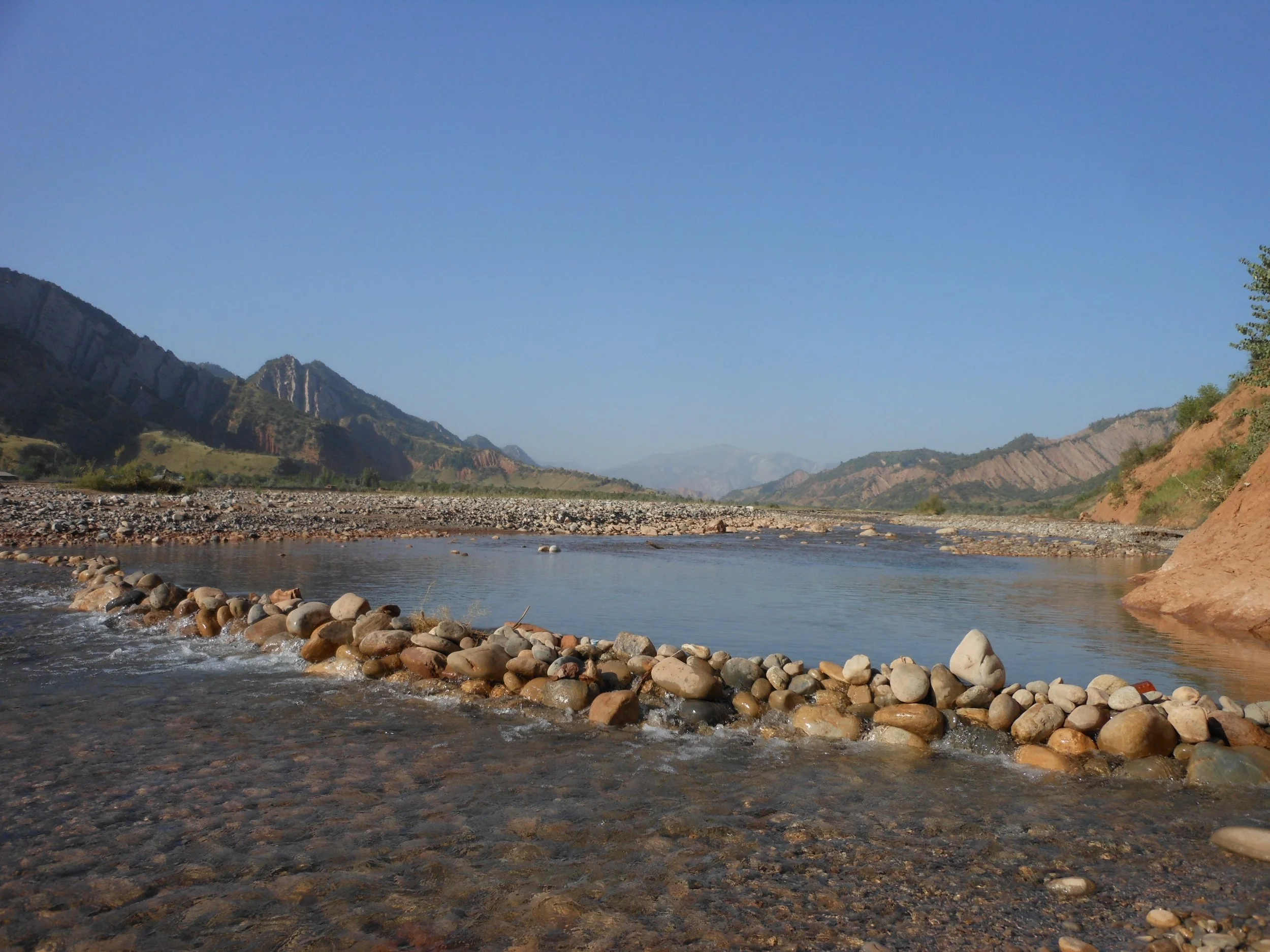
The main river is called Surkhob, a common river name that you will see in other places in Tajkistan - including the most famous one that you cross on the first day of the Bactrian Trail. This river, depending on when you pass through and the amount of that that year, may have some small swimmable pools (photo below). But we make no promises…
In Shaydon village there are some small village shops and a small hotel. The hotel was operating as of 2022, but I haven’t checked more recently.
Section #11: Sari Khosor to Baljuvon
This is one of the original sections that needed to be changed. My locals friends always encouraged me to hike up the gorge to the northwest from Shaydon, get on a ridgetop and hike to Baljuvon from there, or drop down into a gorge to the north that also leads to Baljuvon. But this ridgetop area and the gorge below is now, from what I can tell, some sort of private dacha, hunting and off-road driving area for high ranking VIPs. So high that you should not anywhere in this area.
A ridge walk on the opposite side of the valley is dusty and dry and not so interesting. So I’ve decide to make the route just follow the Surkhob River to Baljuvon. This is the sort of terrain where, when you are not on a trail at the edge of the mountain slopes, you pick your own terrain through river rocks - and occasionally do an easy crossing of the river. I’ve walked some of it, but not all of it. My GPS track is just a vague suggestion. I’ve driven the main road many times, but you should definitely not do a road walk on the dirt road that connects Shaydon to Baljuvon: it is dusty, hot and boring. Stay by the river.
As for drinking water, I can’t remember when I got water from some side streams and a village stand pipe. But the halfway village of Doshmandi is a guarantee of water.
As for the river crossings, this pic is from a drive between Shaydon and Baljuvon a decade ago. It gives a good look at the water level in late summer. The later you are here in the fall, the lower the water will be. The water is not cold.

Section #12: Baljuvon to Sebiston
This is an exploration section. This is the only section about which I have had zero conversations with locals. I’m just following shepherd trails I see on satellite imagery. The GPS track is drawn manually.
I have few worries about terrain and obstacles, but I worry about water. 23 km from Baljuvon, after the first ridge, is a shepherd camp in a gorge. If you arrive here without any remaining water, and you can’t find water here, then you will not make it up to the next ridge and make the long trip down that ridge to the village of Kulisufiyon, the first guaranteed water source.
As for difficult terrain, after the shepherd camp there is a short 1km section leading to the top of the ridge that has no visible trails, and is likely scrambling up a steep rocky slop. Based on satellite imagery, I think I can get up this without too much trouble. But I have made a wrong guess in the past based on looking at satellite images.
After a short section on the ridge you will come across goat trail, and then eventually a dirt road down to the village of Kulisufiyon. After this there is a dirt road walk until an eventual shortcut through grassland foothills to the roadside town of Sebiston (“Land of Apples“), which officially had its name changed to “Khoja Shaqiqi Balkhi.“ There is possibly a hotel here (someone has added an unnamed, unconfirmed hotel to Google Maps). The town is big enough to easily resupply on food. It is on the main road, and this is your last chance to easily exit the route and go to Dushanbe. Stand by the road with your hand out and say “Dushanbe“ when a car stops. There will be plenty of people going to Dushanbe.
There is an alternate road walking route to skip the exploration section. However, it is a road walk.
Next section: Sebiston to Levakant