Immat Glacier
Immat Glacier
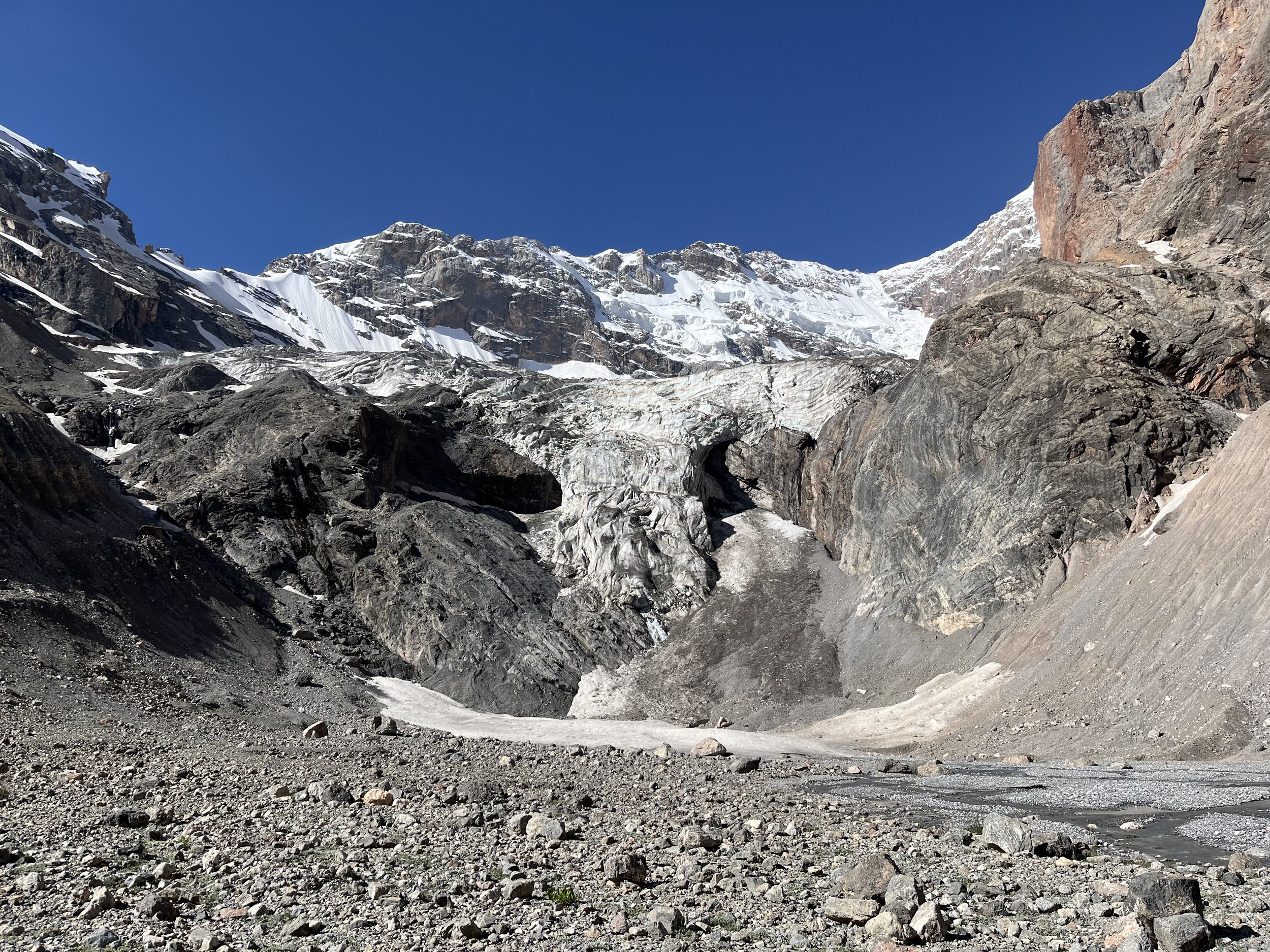
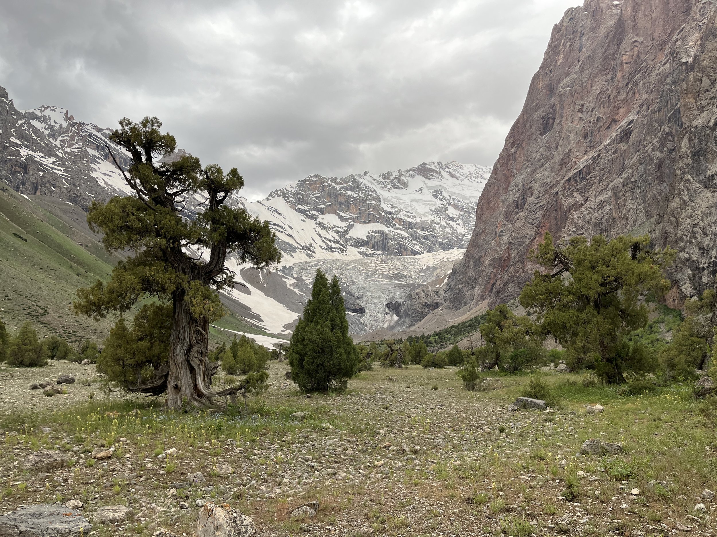
The Fann Mountains’ Immat Glacier is the easiest place in Tajikistan to see a glacier up close. There are shepherd trails to the top of the Immat Gorge, and then easy open terrain after that. The local shepherds tell me that this area is rarely visited by tourists - despite being so close to heavily visited places such as Alauddin Lake.
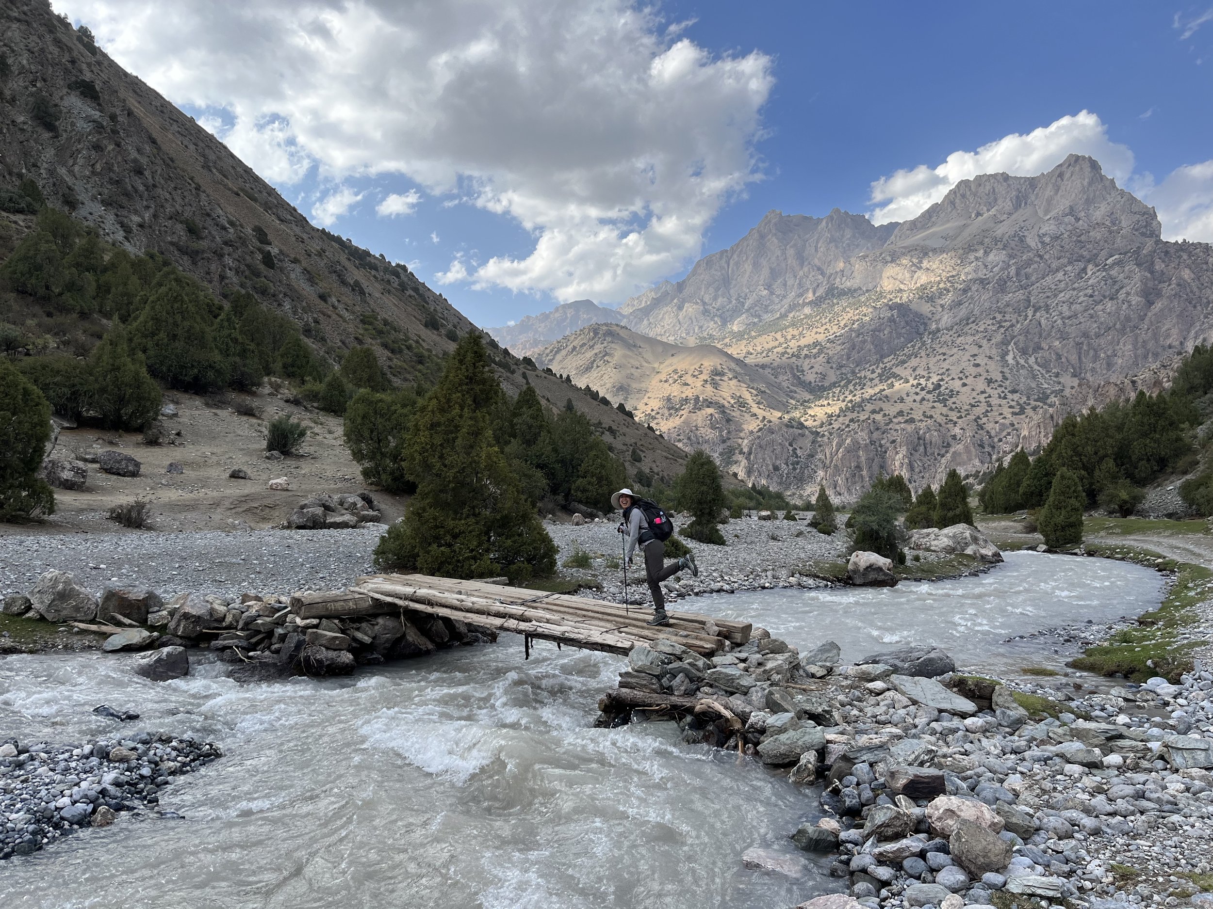
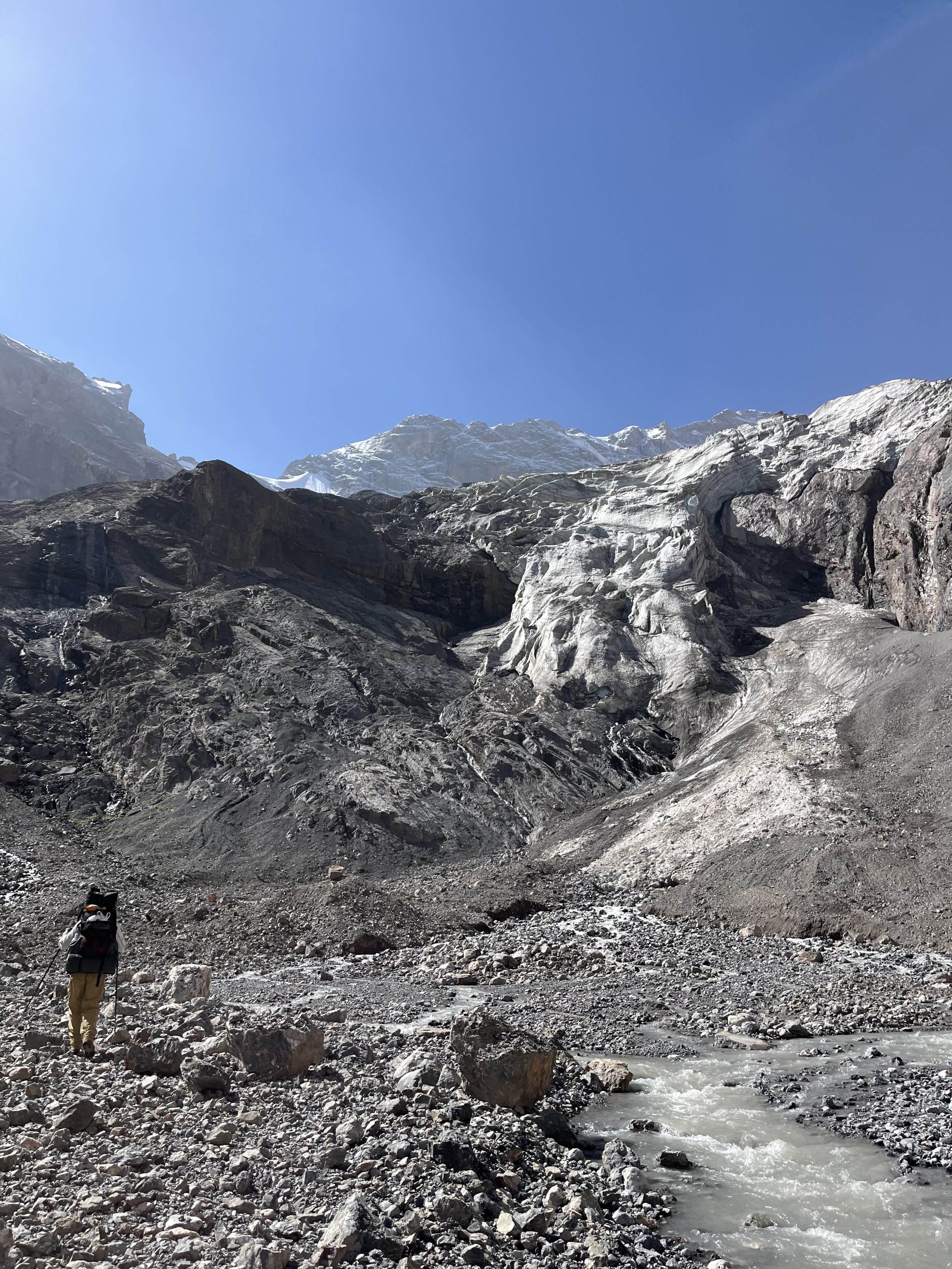
There is very little information required to do a hike here. The two footbridges you need to use are both maintained by the shepherds who live here from May through September. At the top of the gorge you can easily cross the wide shallow braided streams coming off the glacier. At the bottom of the gorge you should start with plenty of water to make it to the higher side streams or springs. These are all clearly labelled on the map.
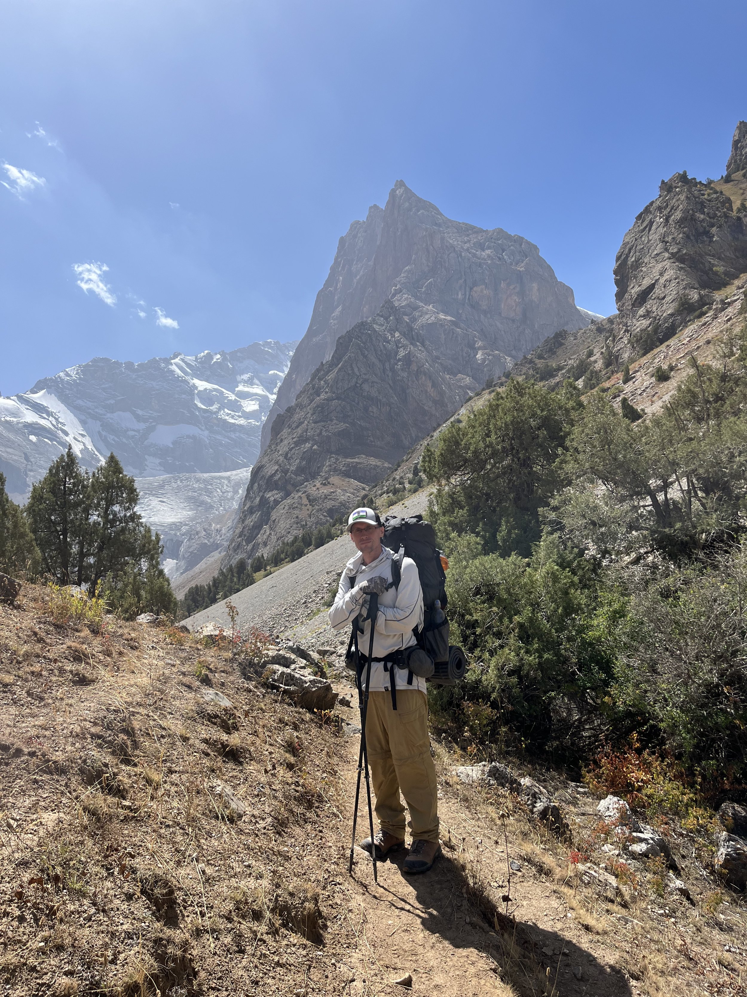
There are two ways to get to the start of this hike. The first is the quick and direct approach from the town of Sarvoda on the main north-south highway, the other way is to start from the village of Artuch and visit the more popular areas of Kulikalon and Alauddin Lakes on your way to Immat. The GPS track below is the longer version of visiting Immat Glacier, but it can also be used for the Sarvoda approach.
GPS track: Download GPX
All transportation instructions below are for budget travelers. If you have lots of money, then just pay a tour company to drive you. They won’t know Immat, but just refer to places nearby for driving instructions (Alauddin Lake or Artuch Alplager).
Getting to Sarvoda: Sarvoda, being on the main north-south highway, is known to all shared taxi drivers (plus the “Asia Express” bus drivers) who do these routes: Dushanbe to Panjakent, Dushanbe to Ayni, and Dushanbe to Khujand. The problem is that they will want the full fee for the entire trip, as they won’t be likely to easily find another passenger after dropping you off in Sarvoda. The links below are for getting from city to city, but they work as well for getting off half-way in Sarvoda. Price negotiations are up to you.
Instructions for starting your trip from Khujand (after crossing border from Tashkent).
Instructions for starting your trip from Panjakent (after crossing border from Samarkand)
Getting from Sarvoda to the start of the Immat Glacier hike:
1. You can walk up the road (17km). There are a couple of kilometers as you pass below the coal mine where the road is not pleasant, but after that I enjoyed it (comparable to other road walks). The traffic is minimal and the villages friendly. If you don’t trust the stream water you see, ask locals for a refill when passing through a village (a smile and a wave of an empty water bottle will be understood; male tourists should ask local men or older boys, female tourists can ask anybody).
2. A 4WD taxi from Sarvoda. Six of eight times I’ve gotten out of a taxi in Sarvoda, other taxi drivers with 4WD jeeps or SUVs have ran over to offer me a ride to Alauddin Lake (the “Vertikal“ camp). After the last village you need a 4x4 car to get up a steep section of road. The asking price here for the ride is 300-400 Somoni (as of my last trip in 2023). The are some young men here who are not trustworthy (one asked for 300, then tried to change the price to 400 upon arrival - I gave him 300 and walked away). The older men are more honest. The price to drop you off at the start of the Immat hike will probably be the same as the trip all the way to the top of the road (the “Vertikal“ camp). The taxi drivers will say “Alauddin?“ (or maybe “Vertikal Alauddin?“). If they are an actual local who knows the area, reply with “Istomsang,“ “Sangi Safed“ and/or “Surkhob.“ Istomsang is the shepherd village near the beginning of the hike, Surkhob is the river that joins the Pasrud river at the start of the hike, and Sangi Safed is the general name of that area by the confluence of rivers. Istomsang is easy to pronounce, Sangi Safed is “san-gee sa-fed“ and for Surkhob the “kh“ is like ‘ch‘ in German. The name “Immat“ is likely only known to shepherds who work in this area.
3. A roadwalk and then a taxi: one of the times I visited I just ignored the taxi drivers in Sarvoda and started to walk. On the road cars will occasionally pass by and offer a (paid) ride. If the car is a 2WD, they are only offering you a ride as high as the village they are returning to. If a 4WD car stops and offers you a ride to the top they will ask “Alauddin?“ Just refer to the instructions above for getting to the start of the hike. My experiences with drivers I meet on the roadwalk is much better than those waiting in Sarvoda. On my most recent trip I got lucky on the roadwalk and a driver was on his way to visit his wife, children and grandchildren in Istomsang.
There is a ranger station at the beginning of the hike that is usually not attended. I have never seen anybody here in the 10 times I’ve passed through. But if there is a ranger on duty, you may need to pay a ~20 Somoni per night per person camping fee (the same fee collected at Alauddin Lake and for the Kulikalon area).
Getting to Artuch: If you want to do a longer trip from the west, then start at Camp Artuch - known to locals as “Artuch Alplager“ to distinguish it from the village of Artuch lower down the road. For transportation instructions, search online for anecdotes and reports on how to get from Panjakent to Camp Artuch. Regular public transportation will only get you as close as the village of Panjrud, after this it is unpredictable (a driver may offer a paid ride as far as Artuch or Camp Artuch, or you may have to walk). Some accommodation in Panjakent can arrange for a driver from your door to Camp Artuch (obviously at a higher rate than hitching rides).
Additional Information
After my two visits to Immat I edited Open Street Map data. Your offline map should now show all the placenames, springs, bridges, trails and good camping spots.
The shepherd village of Istomsang was inhabited in both June and September. It’s a dairy camp with mostly women and children. The upper shepherd village of Immat has a shorter season (July and August), so was empty for both of my trips.
Best time to visit? Late June until early October. But you can visit earlier or later if the weather cooperates.
Alternate Routes
If you are coming from Alauddin Lake or want to go to Alauddin after Immat, there are hiking routes over the two ridges using Talbas Pass and Surkhob Pass - as opposed to doing the roadwalk. The roadwalk is actually quite nice - but it’s understandable if you don’t want to retrace your steps down to Istomsang. If you do go over the ridges, know that the trails are not always clear, and the western approach to Surkhob Pass is steep and rocky in a dry gorge.
If you want to connect from Immat to Iskandarkul Lake, you need to go through Lower Zinakh Pass or Upper Zinakh Pass. I went through Lower Zinakh Pass in the first week of July - with just enough snowmelt to make it through on dry ground. However, there was dangerous rockfall from both slopes on the Immat side. A local shepherd confirmed the report that I read - a climber was killed here a decade ago by falling rock. I thought I could avoid the obvious rockfall danger from the snowy/icy cliff side, but there was also some rockfall from the dry side (so, rockfall is unavoidable). Furthermore, it is very steep and loose right before the top. It is steep enough that if you fall, you might not be able to stop yourself. Is Upper Zinakh Pass any safer or easier? That’s unknown. I would only go exploring in this pass if you understand that the dangers may be the same as Lower Zinakh Pass (and wait until mid-July for enough snow to melt out of the pass). Note that the locals do not recognize the name “Zinakh Pass“ - just the placename Zinakh. Once I said the name of the village on the other side of the mountain, they understood what pass I was headed for (and noted that they don’t use that pass).
There is also Turzul Pass that connects to the east (and back down to Sarvoda). It looks like a very steep east side with lots of rockfall. The trails seen on satellite are ibex routes, not shepherd or livestock trails.