Murghob to Bachor
Murghob to Bachor High Route
*This is a work in progress* I add information as I find it… Don’t attempt this route. This page is available publicly so that anyone researching travel in this area can make use of what I have found.
This proposed/planned route starts right in the town of Murghob and ends in the village of Bachor, a well known start/end point for treks. The first third and the last third of this trek are well traveled areas, either by shepherds or tourists. It’s the middle third that has next to zero information available. And with the challenge of two unknown gorges and one 5300 meter pass that will require some glacier travel, this middle section may be impossible.
First of Three Sections: Murghob —> Eastern Pshart Valley —> Gumbezkul Pass —> down Murghob River —> Modiyan shepherd camp.
All of this route is on car roads, except for Gumbezkul Pass. They are pleasant, scenic roads with minimal traffic. The point of Gumbezkul Pass (4731 meters) instead of just walking straight to Modiyan is to do an acclimatization hike. So if you are already acclimatized to the mid-4000s, then you could just hire a driver to take you straight to the Modiyan shepherd camp (just ask to go to the end of the road in the Modiyan/Madiyan valley).
What is Gumbezkul Pass like? Wide open and east terrain, but a rough uphill if you are not acclimatized. You can see for yourself in the two videos below, both from the late season (one late September and the other mid-October). The first video is entirely about this hike, and the second video only features Gumbezkul (AKA Gumbezkol) for the first two minutes. Don’t worry about what the narrator said about navigation. This route is now on the map.
The Third of Three Sections
The third section is a relatively well visited trekking area near Bachor: Zaroshukul and Chapdarkul lakes. You would enter this area from the middle second section via the easy Ramaif Pass. There are multiple options to get from Ramaif Pass to the Bachor guesthouses. Those routes are easy to see on the map. You can see a video of Chapdarkul here, and the two photos below by Slava Zavyalov give you a quick idea of what Zaroshkul Lake looks like. Read his full report on this area, along with the rest of his photos.
There is a popular trekking route through this area: the Bachor-Bardara trek through Bardara/Shteklozar Pass. For more info, see Route 18 and 19 in the Trekking in Tajikistan guidebook. It’s possible to join this trek in the middle and turn west to the Bartang Valley instead of going to the village of Bachor. But likely you will be out of food and out of battery by this point and you’ll want to get to a guesthouse and then drive to Khorugh the next day. The other direction takes you to a small village in the upper Bartang Valley that’s far from everything.
The Second/Middle Section
This is the longest and by far the most difficult. It involves hiking down the Murghob River and possibly crossing the river multiple times, scrambling over a very steep ridge, going up a very long and very rough gorge, crossing a 5300 meter pass, going down a river gorge with multiple difficult river crossings, and then up a steep gorge and over Ramaif Pass.
If you are curious, the route that nobody has fully done and that I may attempt in the future is this: Modiyan shepherd camp —> down Murghob River —> Jekandikul Lake —> over unnamed ridge to southwest —> up Oq-Jilga Gorge —> over unnamed 5300 meter pass —> down Marjanay River to Lake Sarez —> up Ramaif Gorge.
This route may be impossible. It may be possible, but so long, difficult and tiring that you are forced to turn back.
Season: River crossings are vital here, as is the need for minimal snow on the high pass. This means September is the only option.
The Rivers: Multiple crossings of the Murghob, Oq-Jilga and Marjanay Rivers, plus countless smaller streams and creeks.
Murghob River: After the Modiyon shepherd camp you will at first follow an easy path: the faded remains of an old bulldozed track that goes down river (west) until almost 3500 meters (elevation). After this it will be very unpredictable. The old GenShtab map (“Soviet Military“ map) shows a route that continues downriver all the way to the confluence with the Western Pshart River, crossing the Murghob twice. This route may be fictional. Perhaps in low water and on a good horse this route is possible, but all imagery from boaters show canyons that are impassable or so time consuming to be not worth it. But that’s after Jekandikul Lake (where the proposed route turns south). So it may be possible to easily get to the Jekandikul Lake area. But this may be only in the low water season. Or it may be a horseback route that is often in water - not a good plan for a hiker who would soon get hypothermia. This is definitely a “I won’t know until I get there“ situation.
If you want to do your own research, you can view the GenShtab map of this area on Nakarte. Note that you can switch between layers to see the map or multiple satellite views or Open Street Map.
Ridge Crossing: The next obstacle, after crossing the Bardara River, is to get over the ridge to the East Oq-Jilga Gorge. If you look at topo and satellite maps, the ridge appears to be easier farther south, up the Bardara RIver. Or perhaps you can cross the ridge right at Jekandikul Lake. Is the ridge impossible? And you don’t want to go back to Murghob? You can try the old route up the Bazardara Gorge to the Bazardara Pass. Eventually you will come across a mining road that will drop you onto the Pamir Highway north of the village of Alichur.
If you do get into the East Oq-Jilga Gorge, you will need to go down the gorge to the main Oq-Jilga Gorge.
Can you just skip the ridge crossing by going farther down the Murghob River. Maybe. But cliffs come right down to the river edge in multiple locations. And in one spot the current pushes agains a cliff. If it’s shallow and safe, I’ll give it a try. Otherwise, over the ridge.
Oq-Jilga Gorge: Likely very rough, very long, with multiple river crossings or hikes up the mountain to avoid obstacles. If you want to take a good look at it, click this link. It will start you where the East Oq-Jilga Gorge comes down to the Oq-Jilga River. Go to the southwest up the river to see what obstacles you may face until you turn west up a small tributary at 4100 meters. I count two possible river crossings until the river floor widens at about 3620 meters. Eventually the gorge narrows again and it appears to be unrelenting scree and talus. This may be bad enough for you to turn back.
As for the name, Oq-Jilga is a common Kyrgyz name for gorges, rivers and streams in the north Pamirs. You will also see it written Ak-Jilga or Ak-Dzhilga. Oq/ak is ‘white,‘ and jilga is a gorge with a mountain stream or river that may in sections be intermittent. So if you are searching online or on a map you may come across a reference to a different river (probably the more well-known one near Qarokul Lake).
The high unnamed pass: 5300 meters high. Glacier to glacier. The southern glacier can likely be avoided, the north cannot be avoided. There is also a cornice. This may require crampons and an ice ax. This is a pass that would make a mountain climber yawn, but may be a serious problem or deadly for a hiker, especially considering the height and possibility of snow on any day of the year. I would only recommend showing up to this pass if you have the gear and experience.
You can view satellite imagery of this pass here or here.
Marjanay River: First of all, I need to discuss the name of this river to avoid some confusion. This place name occurs regularly throughout the mountains to the south of Lake Sarez (for both rivers and passes). One incorrect interpretation of the name is “Corral Springs“ (corral existed historically in Central Asia only as an expensive Chinese import jewelry). Only a historical linguist who studies Bartangi would have a chance at finding out what it means. Or perhaps a local person would know. But the problems is that the people who lived nearby died in a massive 1911 landslide (Usoi village) or fled the ensuing flood and lake formation (Sarez village). On old maps the Marjanay River came right down to the now underwater village of Sarez. It was their name, and I don’t know if knowledge has been preserved after they fled to the Bartang Valley. The name Marjanay is also given to two rivers on the opposite side of the ridge by Yashilkul Lake: Big Marjanay and Little Marjanay. It’s not uncommon in Tajikistan for the opposite side of a ridge or pass to have rivers with the same name. Russian map makers solved this by adding north/south or east west, or by using a different name. You might come across the Kyrgyz variant “Kattamarjanay“ or “Katta-Marjanay“ for the Marjanay River. This means “Big Marjanay,“ which makes it even more confusing - giving the map two Big Marjanays. The Russians solved this by referring to one in Kyrgyz, and the other in Russian “Bolshoy Marjanay.“ The current situation on Open Street Maps is that the Marjanay River that flows into Sarez Lake keeps its name as the river is referred to by early pre-flood visitors to Sarez as Marjanau and Marjanay only. Big and Little Marjanay appear on the OSM map on the rivers/streams that flow into Yashilkul.
As for traveling down this river, regardless of its name, you have an immediate escape route after coming down form the 5300 meter pass: the easy Marjanay Pass to the south that will take you right to Yashilkul. Note to be confused with the Marjanay (AKA Shadau) pass at the west end of Lake Sarez.
But I plan to go down this river to Lake Sarez, not go through Marjanay Pass (AKA Shaytan Pass). The plan is to do a September low-water trip after the melt season has ended. This is an old shepherd and caravan route, and there are no difficulties except for river crossings. The old caravan route is entirely on the right bank (north east side of the river), from the Suydi River tributary to Lake Sarez. But the GenShtab map tells many lies. This may be one. An old trail can be seen on satellite, but then fades away where floods or moving scree enveloped it. So even in times of low water you may need to get in the river.
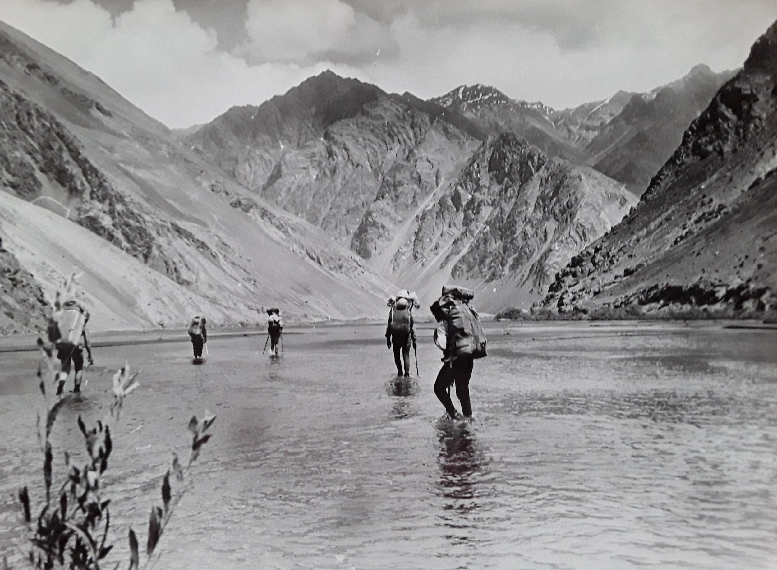
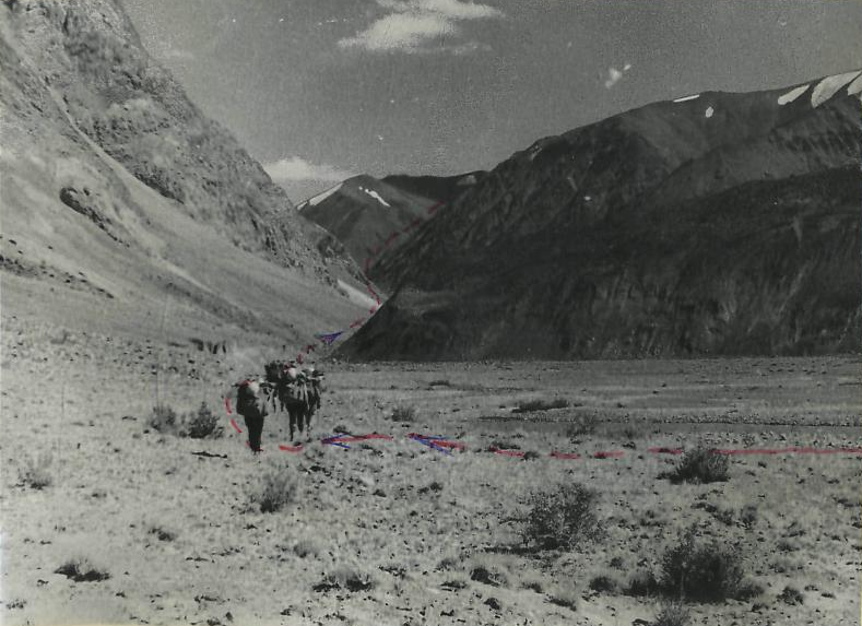
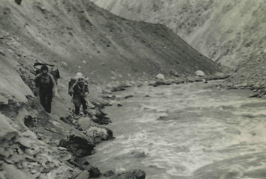
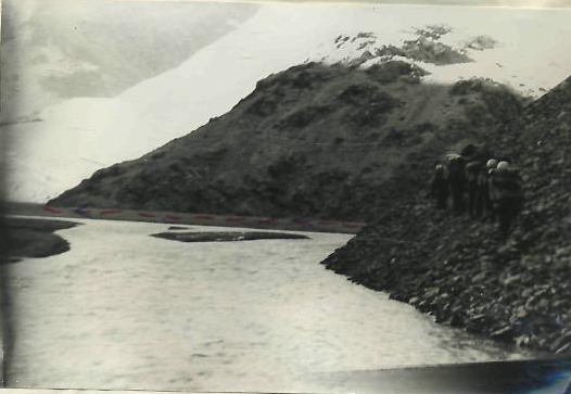
In 1977 the Dunaevsky group from Dushanbe traveled up the Marjonay River form Lake Sarez. They took photos (below) of the difficult sections (for technical purposes, not for scenery). But their route selection may not be relevant, as they traveled during peak meltwater time: August 10th and 11th.


The Dunaevsky group reported that the Marjanay River was difficult to cross, even in the early morning when the water was lower. They report multiple river crossings, including by the use of their gear (ropes, harnesses, etc.), plus going up and around bluffs/cliffs that go down to the water.
Again, none of the Dunaevsky group’s experience may be relevant if you come here when the river levels are lower. What is relevant to the tired and cold hiker is the hot springs. The reported the location as being above the only major tributary river along the left bank. So, perhaps above the Gyols River. The groups provided a blurry photo of a pool that is three meters in diameter, but you can’t see the background to get an idea where it is. And that’s too small to find with thermal imaging satellite data. Also, this was 1977. So it may have disappeared or flooded away. And if you find a copy of their report, you will see their mention of a shepherd camp that appeared to have been used earlier in the year. This is no longer used, as satellite data clearly show no sign of grazing or shepherd camps here anymore.
Ramaif Gorge: One group reported that it took them 3 hours to get from the Marjanay River to the Ramaif River along Lake Sarez. I’m not sure how that’s possible - just avoid the cliffs next to the Ramaif River by going up and around. As for the gorge itself, it’s rock. Very rocky. There is scree, talus, rock glaciers and boulders. But the three accounts I can find just note that is slow. There is nothing to stop you. In the upper gorge the terrain opens up and walking is easier, with some trails that can be seen on satellite/aerial imagery. There appears to be some yak grazing here in the upper Ramaif, but it’s not clear is shepherds are here regularly or not. You can see some low quality black and white photos of the Ramif Gorge here (you’ll need to read Russian cursive for the captions).
Ramaif Pass: An easy shepherd pass. 4597 meters high. There are several passes with this name or a similar name. The others are difficult mountaineering passes. You can see an account of the pass and photos from the upper Ramaif Gorge here.

