Ti Shakh Pass
Ti Shakh Pass
Ti Shakh Pass refers to three different passes at the head of the Ti Shakh Gorge. Two passes go to the Dashti Ziyorat pastures, and one goes to the Gulboz pastures. Dashti Ziyorat’s river system drains to the Rasht valley (Surkhob/Vakhsh River), and the Gulboz pastures are the headwaters of the Yaghnob River.
Passes:
Ti Shakh Pass (late summer to early fall) - 4270 meters
Ti Shakh Glacier Pass - 4190 meters
Ti Shakh-Gulboz Pass - 4357 meters
Difficulty ratings: The Ti Shakh Pass (late summer to early fall) and Ti Shakh-Gulboz Pass both have a 1B rating in the Soviet/Russian alpine grading scale, and Ti Shakh pass on the glacier is not rated by climbers, but should be a 1A in my estimation (but only in early summer).
Why do this pass? Shepherds go over Ti Shakh Pass to access the large grazing areas of Dashti Ziyorat and Gulboz. Climbers use these as easier passes to access more difficult routes. Trekkers and hikers may be interested in a challenging and rough pass with great views. Primarily it should be done as part of a loop that crosses and recrosses the Zarafshon mountain range. I did this pass north-to-south to scout out a route from the Zarafshon valley to Romit gorge (with easy access to Dushanbe).
The video below is a summary of my hike through Ti Shakh Pass (the glacier route). The video begins at 2920 meters in the Ti Shakh Gorge, at 12:30 into the video I am standing in the pass. The rest of the video is a hike to the Dashti Ziyorat pastures.
Name: “Ti Shakh“ means “under the rocks/cliff.“ This is the name of the gorge leading to the pass. Russian climbers refer to both the glacier and rock routes as “Ti Shakh,“ but they call Ti Shakh-Gulboz pass “Sentyabrsky“ (September Pass). Some Russians also refer to the Ti Shakh Pass on the glacier as “Volgond Pass.“ No locals use the same terminology as the Russian climbers.
What do the shepherds and locals say? It’s complicated. There is not a strict naming system for the passes - it is more about the destination. In the villages below you say “Ti Shakh Pass” (aghbai Ti Shakh) and they understand that you are heading up the Ti Shakh gorge and going over a pass. But when you talk to the shepherds closer to the top of the gorge they will ask if you are going over the pass to Gulboz or to Dashti Ziyorat. And the two passes going to Dashti Ziyorat are not used at the same time. In early summer the shepherds go the entire way on the glacier (when thick snow covers the glacier’s crevasses). But at some point in August (it varies year to year) they switch to the (Upper/left) Ti Shakh Pass that goes briefly on the lower glacier and then up and over a ridge that should, by August, be snow free (but no guarantee of being snow free). They don’t have separate names for these two passes. They are both “the Ti Shakh pass to Dashti Ziyorat.“ You need to clarify “straight ahead on the glacier“ or “up and to the left on the rocks.“ This obviously requires local language skills.
The flocks going to Dashti Ziyorat use the lower glacier route when going south to their pastures in early summer, then in the fall they return north using the pass that goes over rock. In the transition season, the caravans that resupply the shepherds must determine which route is safer. One shepherd told me that he switches from the glacier route to the rock route when late August snows blanket the glacier and obscure where the crevasses are. Another said that when the crevasses open in mid-summer (date unclear) he doesn’t bother to try and navigate around them, and instead goes on the route over the rocks. Likely a trekker or hiker will be here when there is a switch from one route to the other. This requires being able to determine if a glacier is safe or not. More discussion on that below.
How are they named on the map? (Open Street Map Data)
Ti Shakh Pass (late summer to early fall) 4270
Ti Shakh Glacier Pass 4190
Ti Shakh-Gulboz Pass 4357
GPS track: I won’t share my GPS track for one very good reason - glaciers change. My route was safe when I went through on the 29th of June 2022. Later in the year or the same day in a different year this GPS track may equal death. However… on the upper glacier there was a clear track in the snow to follow. The lower glacier melts more during the day, so the track left by shepherds and flocks had melted and there was not much to see.
What should you do? Ideally, camp and hang out in Ti Shakh gorge until you see a shepherd resupply caravan heading up the gore. You can follow them as I did. I do not know how often supply caravans pass through.
Guides? If you really want to be safe, then you can try to hire a local as a guide. The neighboring villages of Valighond and Istoshon are home to the resupply caravaneers who do this route regularly. You will need to (a) speak Tajik or Russian, and (b) be very patient to arrange this.
Which pass should I go through?
The only people who should go to/from Gulboz through the Ti Shakh-Gulboz Pass are shepherds, or people with experience in dangerous river crossings. Going onward from Gulboz to Yaghnob or Romit involves some dangerous rivers. Some Russian climbers do this, but they use ropes, harnesses and anchor points on both banks of the river. So this article will not discuss that pass.
For the two Ti Shakh passes going to Dashti Ziyorat, you will need to choose: before August you can go up the glacier. But there are no guarantees. A low snow winter followed by a hot early summer could leave the glacier full of open crevasses or thin snow bridges over the crevasses. In this case you should go towards the (Upper/Left) Ti Shakh Pass after a brief trip on the lower glacier (which is much safer than the upper glacier). So at some point in August the resupply caravans will all switch to the upper left pass over the rocks. But here there is still a chance of danger, mostly when walking across any steep snow fields that remain unmelted.
What should I plan for? If you are experienced with snow and glaciers, then this should be easy. And if you arrive with crampons and an ice ax, then nothing short of a terrible snow storm can stop you on the route that goes over the rocks in late summer.
So what does the route to (Upper/Left) Ti Shakh Pass look like? On June 29th 2022 it looked like this looking towards the east (red line added to show the route):
My trip started at midnight, so I have no helpful photos from lower down due to the dark. So below I will use photos from the Russian climbing expeditions. But from my photo above you can see that it is a steep ascent on snow. At this time of year it’s for climbers only.
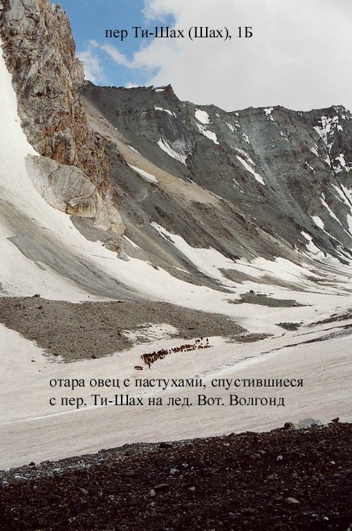
The first photo below is from the 2007 Sergin expedition. The photograph (1 August 2007) is on the north side of the pass, looking south towards the (Upper/Left) Ti Shakh Pass. The pass is at top where the cliff meets the ridge. Note the flock of sheep and the shepherd near the bottom of the photo.
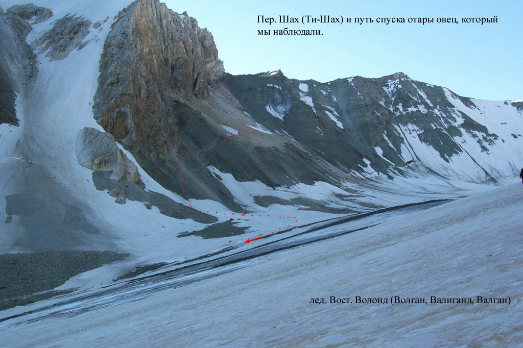
In the photo above you can see a snow-free ascent - not counting the brief and easy snow field at the bottom. But it does look very steep. Another view, from the west looking southeast, shows the route in a way that seems less steep (the faint red dotted line shows the sheep trail) The next photo down was taken from further down the glacier and shows more of the approach:
However, my photo and the photos above from the 2007 Sergin expedition should be used to accurately predict when the ascent to (Upper/Left) Ti Shakh Pass will be snow free. Below are three photos showing very different conditions. The Shirokov expedition (21 August 2010) shows unmelted winter snow. The Borisov expedition (18 August 2014) showing fresh snow. And the Lukyanov expedition (17 August 2017) shows a completely dry slope (the photo at bottom shows the Lukyanov group in the pass, looking west).
If you don’t believe that sheep go through this pass, then you can (as of September 2022) see a large flock of sheep coming up to the pass from the north (the little black dots making long strings are sheep) on this satellite map. If you have an iPhone you can see them at these coordinates (copy and paste them into your Apple map app): 39.28236° N, 69.69154° E
Another large flock can be seen at the tongue of the glacier. This satellite/aerial imagery has no date, but I’m guessing it is at least mid-September (based on how bare the glacier is).
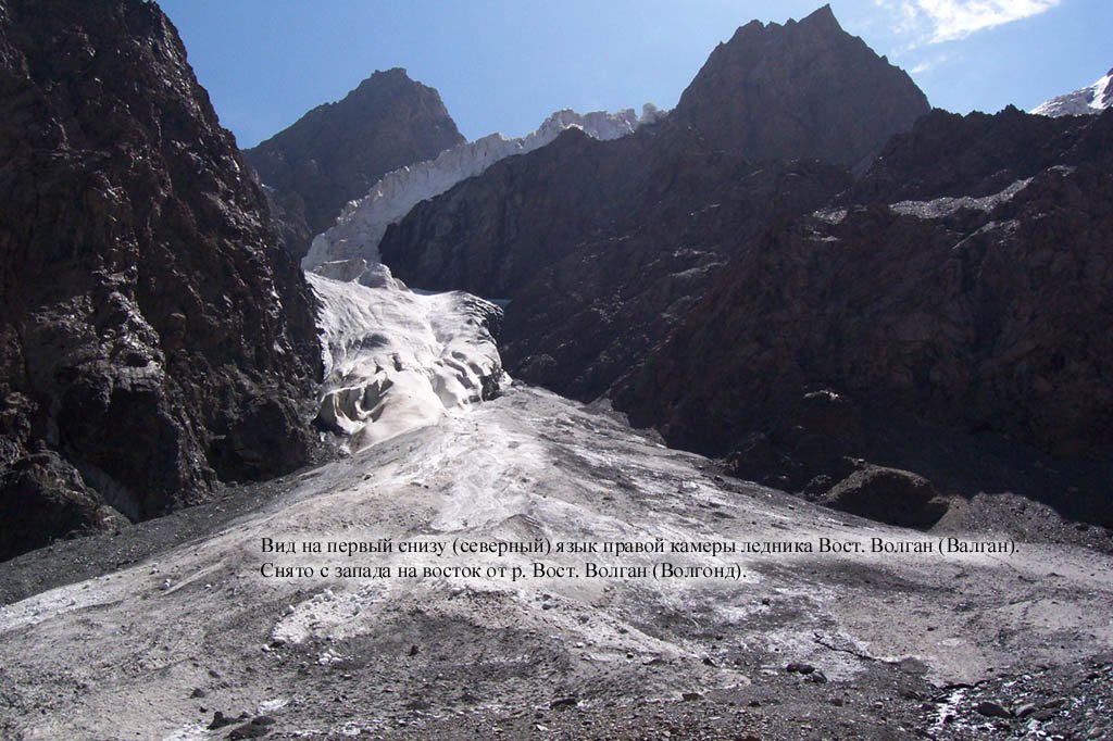
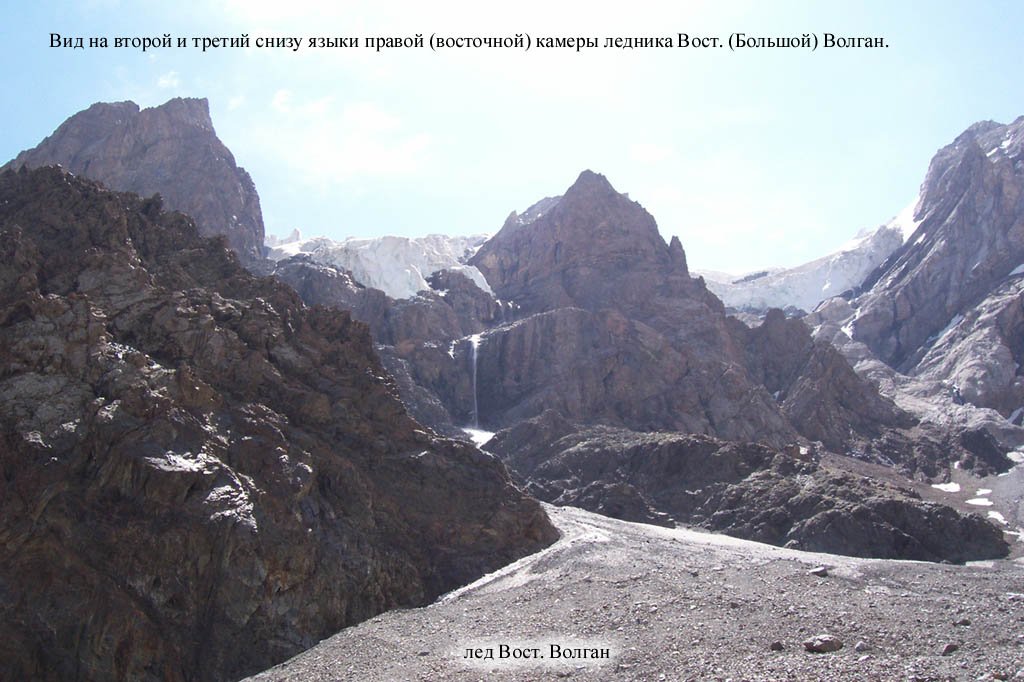
The approach from the north has some difficulties and dangers, well before you even set foot on the glacier. You can see those in my video above. The brief floods and mudflows that come down the ravines in the hotter part of the day when the sun hits the snow/ice above can slow you down or make you stop and wait for the water/mud level to subside. And there are slide paths above the final high camp (3400 meters) that occasionally send down snow, ice and/or rock. Down spend much time in these areas. The slide paths are labelled on the map as “tarma,“ which is Tajik for “slide“), and all are below a hanging glacier. You could not see that in the dark, but the Sergin 2007 expedition pointed their cameras up the slide paths (debris cone) at the hanging glaciers. Photos below:
The approach on the glacier is explained in the video. What needs to be emphasized from that is the necessity to go up the glacier while it is cold at night (so that you don’t sink through the snow or get wet). We started from the high camp at 12 midnight. This requires you to stay at the high camp, which is not a great place to sleep. there are a couple of flat spots under and next to boulders to have a nap, but the area in general is rough and crowded. But it’s your only choice for the glacier route. For the (Upper/Left) Ti Shakh Pass it makes more sense to sleep at the very pleasant 2920 meters camp (the first shot in the video).
Where is the path, exactly? It changes all the time. Everything is moving here. Flooding, moraines, and a glacier change the terrain. After the high camp you need to choose your own route until you get of the glacier (the Upper/Left Ti Shakh Pass does have a visible sheep track after the glacier).
The south side of the pass
My video above show what the descent on the south side of the glacier route is like. The south side of the higher (Upper/Left) Ti Shakh Pass does not have such a sudden drop. But both should be reliably snow free (as they were already by June 29th when I passed through) as the south facing slopes are snow-free very early in the season. Both routes on the south side are mostly open terrain. You can choose how and where to descend. The routes on the map are just suggestions.
What’s next? You descent to the Kolicha river and travel along the left bank (north side). Eventually you will need to choose an avalanche bridge (or a water crossing in late summer) if you are heading to Dashti Ziyorat, and you will stay on the left bank (north side) of the Kolicha if you are looping back north over the Jindon or Demnora Passes. The suggested campsite is at “Duoba“ (“two rivers“) where the two rivers join to form the Obi Duoba river (wrongly labelled “Nasrud“ on old Soviet maps).


