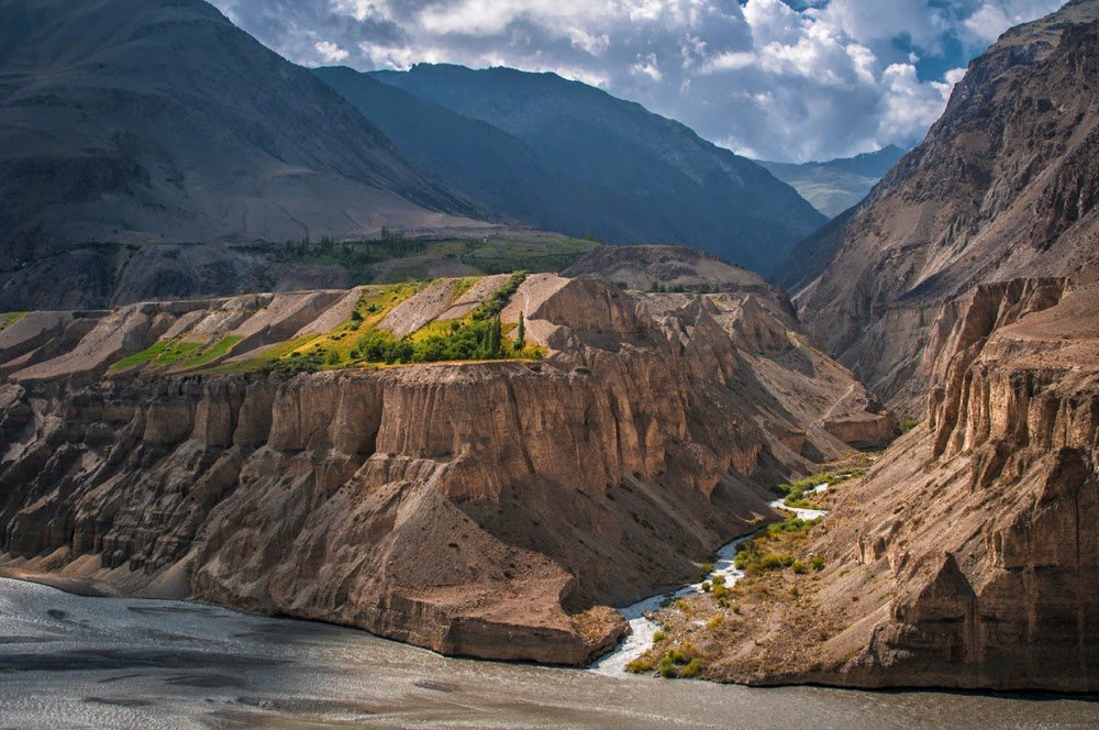
Valighond Gorge
Valighond Gorge
Valighond Gorge, named for the village nearby, is a scenic gorge than can be used to exit or enter an area with excellent hiking and climbing routes.
Name: Valighond, Валиғонд in Tajik, and Волгонд or Волган on old Soviet maps in Russian. All the local people I met in the gorge and nearby were pronouncing the name as “Valghond,“ without the i after the l.
The two upper rivers/gorges are named Sharakho and Ti Shakh. Below the confluence the gorge is named Valighond (but I’m not 100% sure that the entire length of this section is named Valighond - I was unable to confirm the name when I was there, as I was focussed on destinations further up river).
People: All the local people working in the gorge (as shepherds or in some role supporting the shepherds) were from the villages of Valighond and Istoshon. There is a summer village named Sangi Ghavl at the confluence of the Sharakho and Ti Shakh rivers. When I was here, the village was almost entirely women and girls. Two men had just arrived, so I was invited in. But don’t expect men to be here (i.e., don’t stop and try to visit, chat or take photos if you are a male).
Hiking: I did not have time to hike downriver when I was at Sangi Ghavl, so I cannot confirm the trail on the map (any map that uses Open Street Map data). Sometimes a bridge is destroyed and built in a new location. But this is a popular route and I would expect the trail to be very clear and the bridge crossings easy. Note that below 2420 meters the trail goes along the irrigation diversion canal (known locally as an “arik“), not along the river.
You can see the trail on the right side of this photo (left/above). The photographer is standing on the trail looking downstream to the north. Credit: Lukyanov 2017 expedition).
This photo (right/below) of the Valighond gorge, taken by Timofey Rakshin, shows the Valighond river flowing into the Zarafshon river (mislabelled on his blog as the Padask gorge, which is far more narrow than this).
Is there a bridge at the bottom of the gorge? One that allows you to walk to/from the village of Padask? One undated satellite image shows a bridge, other undated images show no bridge, but all images show a path leading down to this area. It’s unclear if there is a bridge or not. If you visit this area, please take a look to see if a bridge is there (and if a path leads up/around the steep grave cliffs on the west side). You can add a note in OsmAnd for Open Street Map editors to see.
Last updated: 1 September 2022

