
Exploring and Mapping Central Asia’s Mountains & Hiking Routes
Only a small percentage of Central Asia’s mountainous terrain, trails and routes have been digitally mapped and described in detail. We’re mapping them and providing practical info on how to get there and what to expect. Our goal is to make the routes that are well-known to shepherds, Soviet/Russian mountaineers, hunters, geologists, botanists, and historians accessible to local and foreign trekkers and hikers who wish to explore the mountains safely (while spending money on local drivers, guesthouses and guides).
What is our methodology? Read below…

“Contrary to our map - we were endlessly surprised and delighted - the “ruins” are actually 7-8 good houses in which families live...”
— 1992 Budyansky climbing expedition notes

How the horses ever got across, even barebacked, still remains a mystery to me. Very steep névé and a staircase cut into clear ice were bad enough, but then came a traverse over a rock slab, where the animals had to place their feet on a tiny ledge...
-German explorer Willi Rickmers, August 1906

At the end of August we took six horses south through the passes. Some passes were already covered with snow… The pass turned out to be harder than I could have imagined.
-Nikolai Vavilov, Russian botanist, 1916 (died in prison, 1943).

The sheep were taken through the pass to the Ghorif pastures on June 20th.
-From a photo posted on Facebook by local resident Shomahmad Shodiev, June 2019.
“I would rate it a 3C or 4A grade in rock climbing.”
Correspondence with Jérémy Bigé after his thru hike across Kyrgyzstan and Tajikistan, discussing a route to/from Ghorif which is too dangerous for hikers.
These accounts above were completed by a visit to the geography professor Ustod Fayzullo who shared this book below, an account of travels in Tajikistan - completed with the only account at that time of Beob Pass.

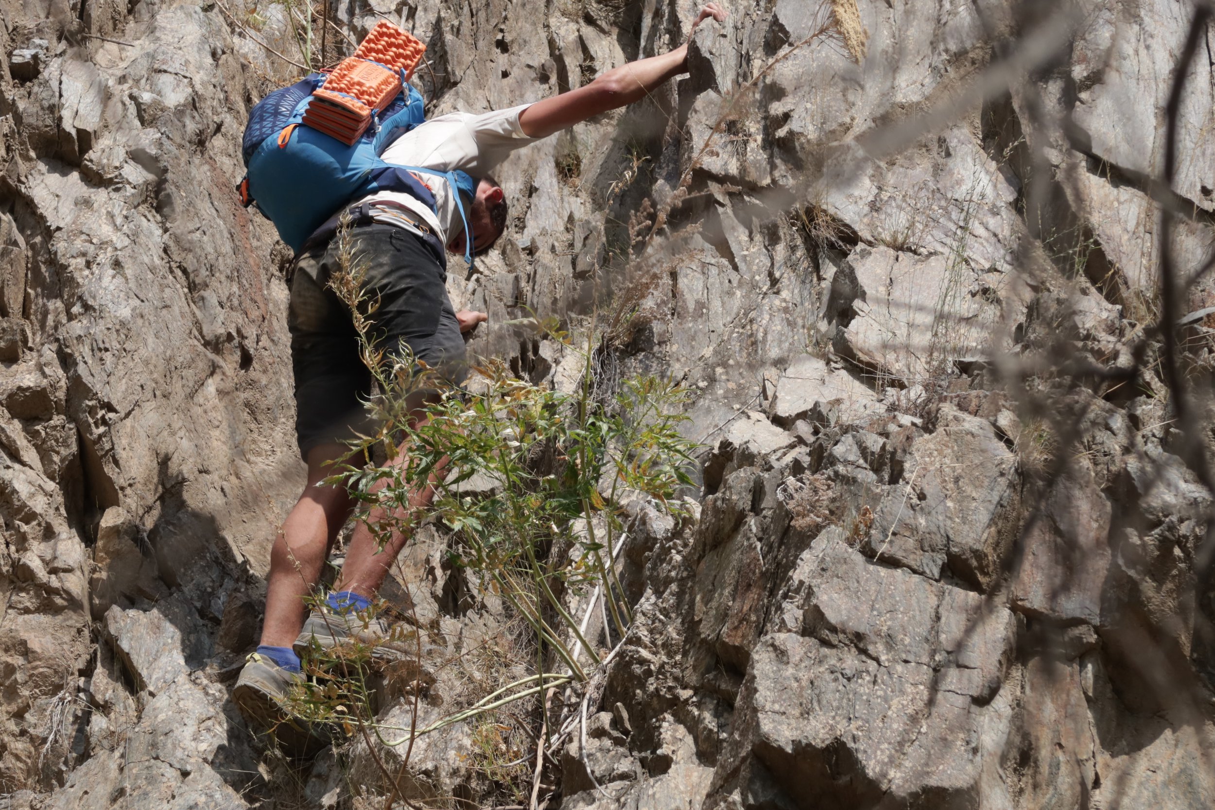
These accounts above are just a few of the historical and contemporary sources used when we mapped a single section from the Pakshif Pass to the village of Ghorif in Tajikistan (and onward), part of a now-disused historical route that connected two regions on either side of the mountains. This info, which was also used to make a recommendation on the best time to travel through the pass, was supplemented by accounts by other Russian climbers, Ukrainian mountain bikers, a pair of Kayakers, a late 1970s traverse by two school teachers and a group of their students, and Tajik hunters, as well as satellite imagery, Facebook comments, email inquiries, GPS tracks, old Russian/Soviet maps, topo/contour maps, etcetera. This was completed by a multi-day hike in summer 2023 to this area to get a time estimate for the route and to speak personally to the local shepherds and villagers about seasonal conditions in the surrounding mountains.
This information was then used by the Pamir Trail team to set their route through this region.
To read more about our mapping methodology, click here. To view all the resources and information we offer, including the map, click here. Generally, the website has not been designed for easy navigation and clear categories of information, but rather for search engines to find pages based on search terms.