Mura Pass
An unpleasant but necessary pass in Tajikistan’s Hisor Mountains
Mura Pass in Tajikistan goes across a manure-covered glacier and past rockfall danger, and involves three river crossings that can be difficult in early summer. The manure is left by the many sheep, goats and donkeys who are driven across by Tajik shepherds who go north over the Hisor ridge in later spring/early summer. Some of the animals break a leg and die in the snow or on the north-side glacier, inspiring a group of climbers to title their trip report “Mura Pass: Road of Death“ (June 10-14, 2020). The short article is accompanied by grisly photos of the remains of animals that did not make it - and were quickly eaten by wolves and vultures. The south-side is much safer, but the scenery between 2200 meters 3200 meters is probably the least beautiful in all of Tajikistan (this elevation range on the south slope of the Hisor mountain range is consistently unattractive).
Note: to follow along with what’s written below, you should have the OsmAnd app open on your phone, with Tajikistan downloaded (including contour lines and hill shading).
And, relevant to tourists, if you want to start or end in the road-end village of Hakimi (north of the town of Shahrinav), then you will have to go through a military (border guards) checkpoint, and they have before turned back tourists who were attempting to go south-to-north. They allow foreigners past in an unpredictable manner, telling some people to go get a permit at some mysterious office.
So, why would anyone want to go through Mura Pass? Well, it’s the safest and easiest pass in Tajikistan’s western Hisor mountain range (between the Uzbek border and the main north-south highway), making it the only realistic option for a hiker (non-climber) to connect the Fann Mountains to any town near Dushanbe. It is also part of the Pamir Trail, if you are doing that long hike. Plus, the scenery really is beautiful in this area, minus the elevation range I listed above. Also, you can skip the unpleasant border guards/military checkpoint north of Hakimi. But you will need to do at least one more high pass (Upper Khonaqo Pass) and two more river crossings. Follow the Pamir Trail map to see this route (Stages 12 through 18).
In 2021 (August 16-22) I hiked from Dushanbe to Iskandarkul lake (actually, the village of Hushyori north of Dushanbe to the village of Saratoq above Iskandarkul). This is covered in my non-narrated video below. Route: village of Hushyori -- Takhob Pass -- Luchob Pass -- abandoned village of Ghofilobod -- Kaynar Pass -- Suboshi meadows -- Upper Khonaqo Pass -- Payron Lake -- Qaratogh River gorge -- Mura Pass -- village of Saratoq (Sarytag). Mura Pass makes an appearance at 14:55.
Basic information on Mura Pass
On the Westra database, Mura pass is listed at 3793 meters (closer to 3780 on newer surveys and on OsmAnd) and given a 1A rating on the Soviet/Russian scale of mountaineering difficulty. That means it’s quite easy…for mountain climbers. Trekkers/hikers may find it to be quite difficult. As noted above, Mura Pass is used by shepherds and their flocks, but at a cost of animals’ lives. The name “Mura“ has been in use for over a hundred years by Russian authorities (and well before that). But the name is confusing, as the pass is not at the top of the Mura River, rather on the Zombar River (the rivers on both side of the pass are both named Zombar). When I arrived in Saratoq I talked to locals who were not involved in the tourism business. When I said I had come through Mura Pass, they were confused. After I said I had come from the Qaratogh (Karatag) gorge, they said “Oh, Zombar!“ So the true name of this pass may be Zombar Pass (or perhaps the non-shepherd locals are just more familiar with the name of the river). As with other passes in Tajikistan, the villagers, long-distance shepherds and Russian mountains climbers often use different names for the same pass. There is a lot of map confusion here. It could also be that Zombar is a name that displaced Mura (which was then given to an adjacent gorge). “Mur“ is an old Soghdian term that means ‘cleft/divide in the mountains,‘ so it’s possible that Russian cartographers/surveyors heard “mur/a“ as a general reference (i.e., “the pass“) and thought it was a proper name.
There are so many references to “Mura” pass in reports, articles and on maps (contemporary and historical) that I will stick to using “Mura Pass” for the rest of the article. Note added in 2025: The government has officially renamed this pass “Muri Pass“ (doubtful to catch on with locals who do not read every government directive).
If my video above shows too little of Mura Pass and the ascent and descent, then watch the video below from a group of Dushanbe hikers.
Dangers and difficulties
The glacier on the north-side of Mura Pass has no name, as is usually the case with glaciers in Tajikistan (they get a descriptor reference such as the name of the pass, river or valley it is near). But some Soviet-era climbers or geologists did attempt to name the glacier “GPP Glacier” in honor of some organization’s acronym. The glacier has no crevasses where you will be walking (but glaciers change, I make no guarantees). Near the very top is a steep section, but most people, sheep and tourists manage to get through it. It should not be bare ice, but rather compact snow. Crampons and an ice ax will give you a lot of confidence here. I personally walked down (south to north) through the steep section in about one minute, and I walked with a single trekking pole at it’s shortest length, ready to use it as a self-arrest device (basically, stab the snow when you fall down). If it’s unclear what I mean, here’s a video of a guy doing a self-arrest with a ski pole (same thing, just a little stronger than a standard trekking pole). And here’s a video of a climber demonstrating the trekking pole technique that I use (starting at 2:14). The steep section does, from anecdotes, seem less steep in early summer when there is still a decent amount of snow on the glacier.
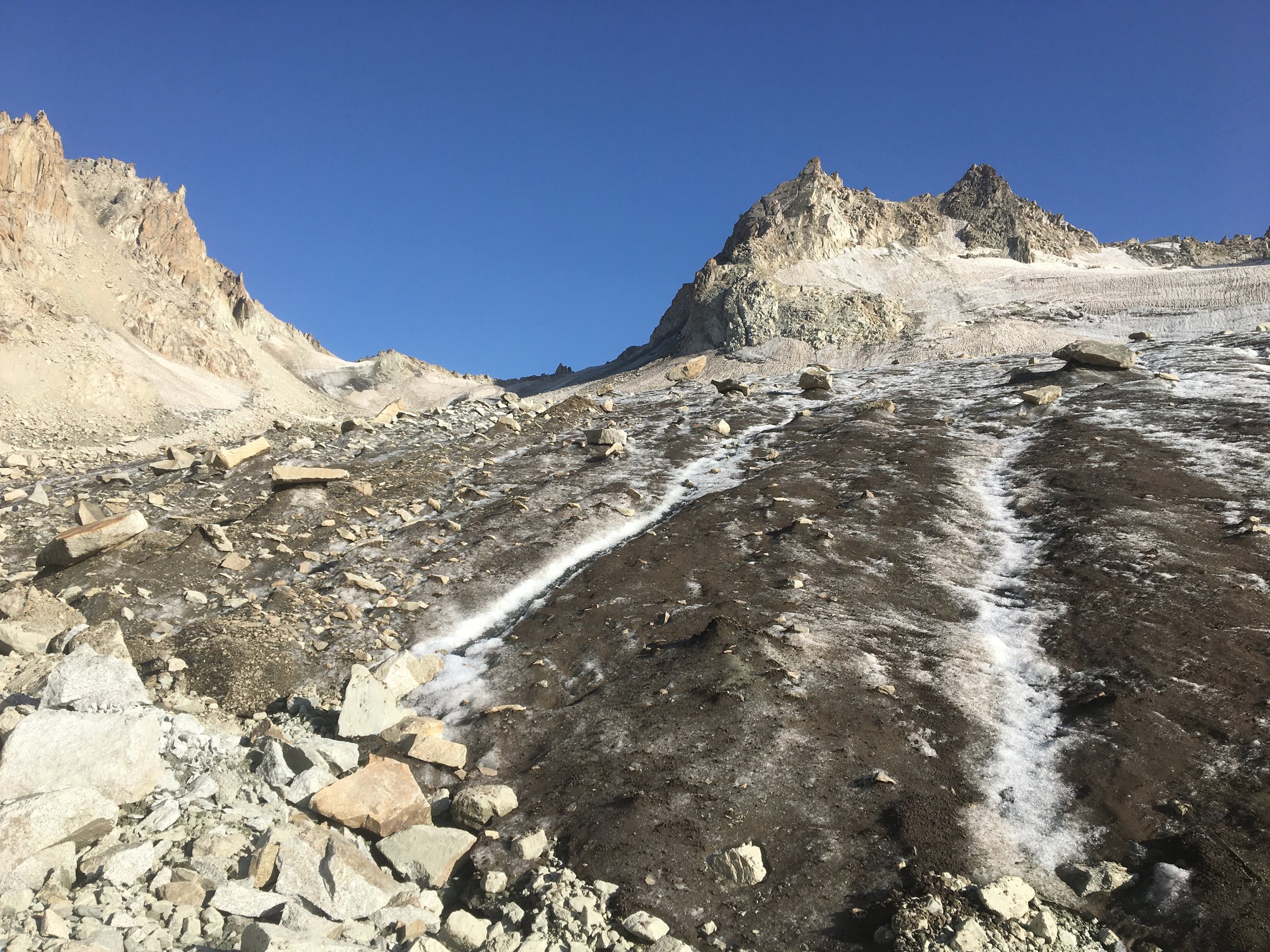
How about rockfall? The glacier has plenty of rocks strewn all over. How many of these fell into place and how many were slowly carried down the glacier is unclear. The further away from the rock cliffs on the west side of the trail, the better. When I traveled through there was active rockfall, but only below the cliffs west of the route you will take. The rocks fell onto the glacier and then fell into a bergschrund crevasse. None of the rocks made it further down the glacier.
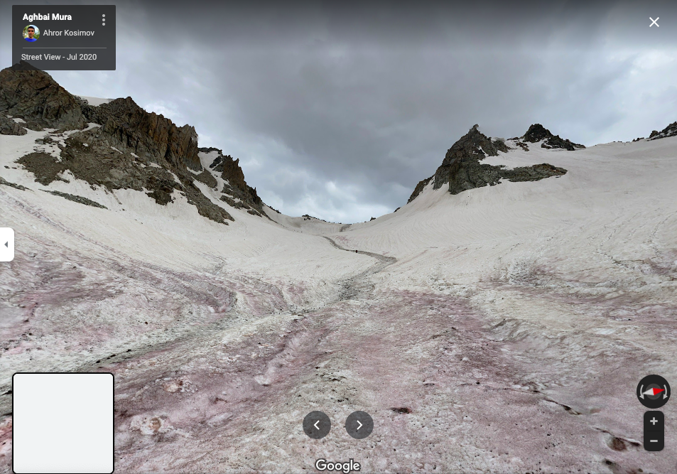
If you would like to see a satellite image of the glacier and of Mura Pass, check out this link at Google Maps. I would guess this image is from near maximum snow melt, so at least mid-August or later. You can see the dirty sheep track going north down the glacier. Furthermore, at this link there are some 360 degree views uploaded by Ahror Kosimov (from about mid-July, perhaps) from atop the pass and below the pass on both sides. In this screenshot below you can see the sheep trail in the snow and the cliff to the right where rocks fall from.
Image from the the north side of the pass, looking south back up Mura Pass.
What does the glacier look like after maximum snow melt (depending on the year, mid-August or later)? Click the following link to the Westra database, where they use an Esri satellite image of the pass (as of early 2022 - it may change) that you can zoom in and out of. Here’s a screenshot below, but you should really click the link to Westra.
What does the glacier look like earlier in the summer when there is still lots of snow? This link to Bing Maps aerial view shows an image that is probably from about mid-July (why it says “Zafarobod“ - a town in far northern Tajikistan - is unclear). If you zoom in you can see a dirty streak in the snow where rocks fall from the cliff and make it about 25% of the way to the sheep track (but note that a large rockfall may make it further than this small regular rockfall). The image is current as of early 2022. But they may upload a new image from a different time of year, so here is a screen shot below that shows what is probably mid-July:
Note the very clear sheep track on the glacier that goes to the north-west.
For a view of this rockfall, watch my 9-second video below, from late August 2021. At this time the rockfall extended about 50% of the way to where the sheep trail is (the trail was no longer clearly visible by this time, as sheep hadn’t been through recently).
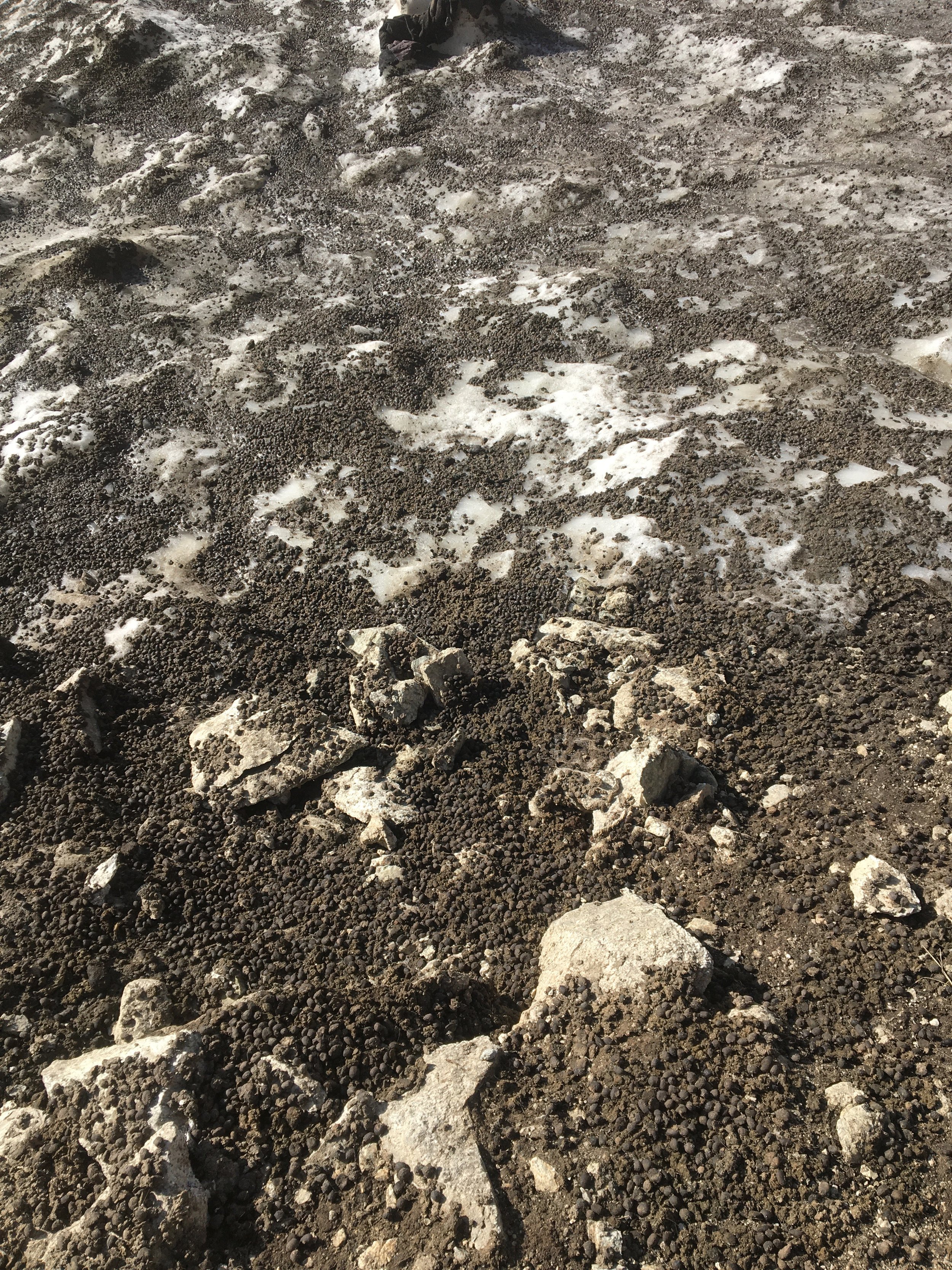
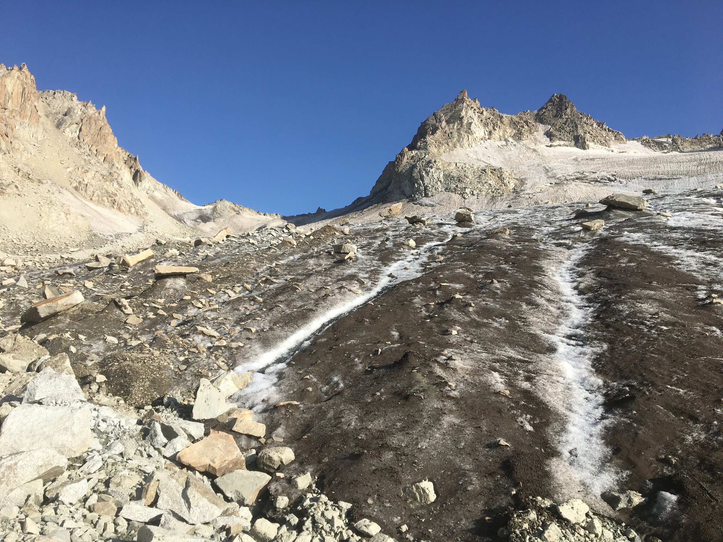
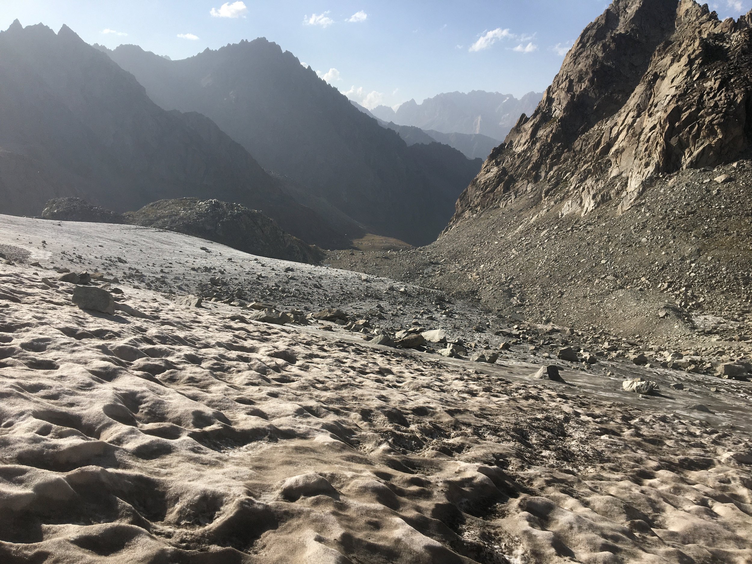
If you want to see what the glacier on Mura Pass looks like in late August, my photos below are from August 21, 2021.
Sheep manure at the top of the glacier.
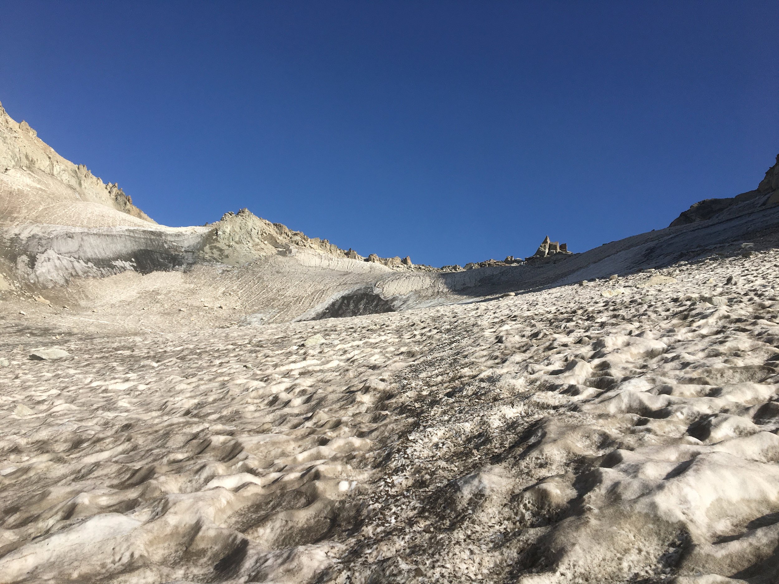
At the bottom of the glacier, looking south towards the pass. The dark brown is a mix of dirt and manure on top of the ice.
Halfway down the glacier. You can still see sheep manure.
Halfway on the glacier, looking down to the north. The rocks seen on the glacier below were slowly carried there, they didn’t arrive at high speed. But there is no guarantee that a bad rockfall won’t reach to where you walk.
Halfway point, looking at the upper part of the glacier. I was following the sheep-manure trail down until it disappeared.
If you want to read other reports (in Russian, or via Google Translate) and see more photos, you can check out these links: Vidanov, August 20, 2015 (scroll down to Day 12), Zavyalov, August 6, 2007, and Titov, August 2, 2012. All three groups have very little to say about Mura Pass because they are mountain climbers and this would be considered a very easy pass for them and not worthy of much commentary. One group walked through, one group walked through with ice axes (but no crampons) and one group went through cautiously with ice axes, crampons, harnesses and roped up. For a good view of what the sheep trail looks like in July, check out the photos at this link.
The Sheep
If you are there in early summer and sheep are going through, get out of the way. Or turn back and go down if there is just a single track cut into the snow. Delay your trip to wait for sheep to go through the pass safely. If you push the sheep off the track, they may die or get lost (as dozens already do every year on this pass). Or you may split the flock. You may be looking at $250,000+ worth of livestock for a larger flock. Have respect for the shepherds’ livelihoods and the animals’ lives. This pass belongs to the shepherds, you are a guest.
The approach to Mura Pass (north and south)
The sheep start to go through in early June, but for you it will be a long and snowy trip, with unmelted snow on both sides of the pass and well below the glacier. This report (June 10-14, 2020) will give you a good idea of what the trip will be like (in short: you have to travel on the snow in very early morning or you will sink through). When will the approaches be fully snow free? Probably by mid- to late-July, depending on how much snowfall there was the previous winter, and how hot the early summer is. Once the approaches are snow free, then you have no worries about terrain. The south side is steep, but not so steep that you will fall down the slope (but there may be a danger of this in a few spots, so pick your route carefully). The southside does have different approaches and multiple faint sheep trails. You can follow the track on the OsmAnd app, as this is the route I took and I had no problems.
Yes, you will encounter sheep guardian dogs, especially on the southern approaches to the pass. Check out our mountain advice on how to deal with dogs.
If you are coming to Tajikistan, you should have a copy of Trekking in Tajikistan, including the e-version on your phone and the GPS tracks that come with the book. However, devastating floods have destroyed bridges and altered the terrain on both the north and southern approaches (I have since made edits in Open Street Map data, so follow the routes on your offline map app). I will describe the new route that is current as of late August 2021. I will go north to south, as that is the direction that most people will take.
You will probably be starting from Iskandarkul lake or from a guesthouse in the village or Saratoq (Sarytag). From here the road goes almost all the way to confluence of the Mura and Qarakul rivers - just over 4.5km west of Saratoq. Here on the wide part of the gorge you will see the effects of the flooding: gravel and sand extend across the entire flat section. Here you just need to walk upriver (there are some goat trails on this hillside above, but walking in the dry river bed next to the river is easier). The route shown in the OsmAnd app is the goat trails - I prefer the flat gravel sections closer to the river. Eventually the gorge narrows and you will be on a trail on the hillside above the river. You will soon be walking through the summer village of Sarikhodan. It’s just a few houses. It was all women and children when I walked through. I never try to talk to women and girls, but the grandmothers (maybe even great-grandmothers?) called me over for a chat and tried to feed me. Women and children villages are common in the mountains in summertime, with the men off somewhere herding the animals or doing other work.
After hiking further upriver from Sarikhodan (well above the river with great views) you get to the confluence of the Mura and Dikondara rivers. This is where the route in the guidebook above diverges from the current route. The guidebook route goes up the Mura River and crosses the Mura River at about 2850 meters. You can no longer do this, as a massive landslide and flood have created an impassable gravel/dirt cliff on the left bank of the Mura River. You would have to go much further upstream to find a place to get up through the new cliffs. So, what you need to do is cross the Mura River just above the confluence with the Dikondara River (at 2630 meters). There is no bridge (as of late August 2021). Here you can cross wherever you want. In late August the water was so low that I could hop from rock to rock without removing my boots. In the video linked above you can see the Tajik trekkers crossing here (from 8:06). But… earlier in the summer you can expect much higher water levels. The trekking guidebook above says that water levels are high in June and July. If you are concerned, make sure to attempt a crossing early in the morning when water levels are lower. And you don’t need to cross in the exact spot shown on the map. The optimum crossing point may change as the river’s course and water levels change.
After fording the river the trail is faint as it goes across open grassy slopes. You will eventually angle towards the west and enter the Zombar gorge (and the trail becomes clear again) and cross the Zombar river at about 2950 meters. It was a simple crossing in late August, but may be more difficult earlier in the summer. You can see my crossing (going south to north) at about 15:40 of my video. After this you will only have very small stream crossings until the other side of the pass.
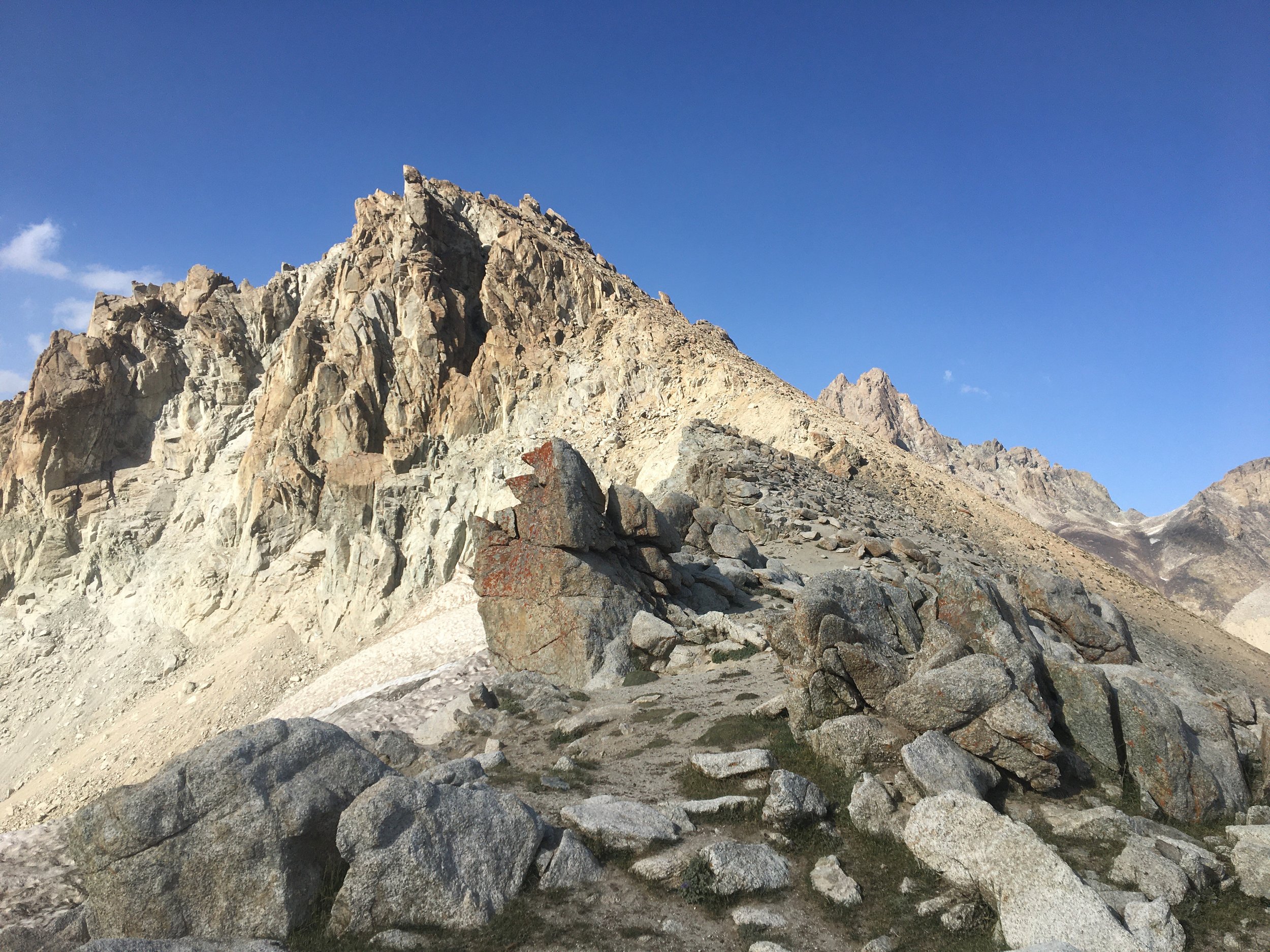
The Zombar gorge has some nice flat and easy sections of wide open grass terrain. If it’s late in the day, you should stop in this area to camp. Above about 3100 meters gets very rocky, steep and with wet ground in many places. Above 3100 meters the trail will appear and disappear, or there will be multiple livestock trails to follow. The rocky terrain gets far worse at about 3350 meters, and you will be walking on and between boulders in some areas, and on steep gravel in others until you reach the glacier. If the sheep can navigate this rocky terrain, then so can you.
How about the sheep camps? There was only one active camp in late August in the Zombar gorge, but earlier in the year there may be more shepherding activity here, and you may have to walk past some angry dogs.
Walking up the glacier should be clear enough, as the info above on the glacier shows. Just be prepared for the steep section near the top (which may be less steep when there is more snow on top of the glacier earlier in the summer).
The view from the pass is quite nice, and it is possible to set up an emergency camp here. But ideally you should be heading southeast towards the small lake (or dried lake) at 3610 meters. It’s flat enough to camp here and there is a good spring northeast of the lake. Between the pass and the lake is steep, with sections of loose gravel and dirt, but you should be able to pick one of the multiple sheep trails that gives you good footing. Once you get close to the lake the trails will again become very faint, and you can choose your own route over open terrain.
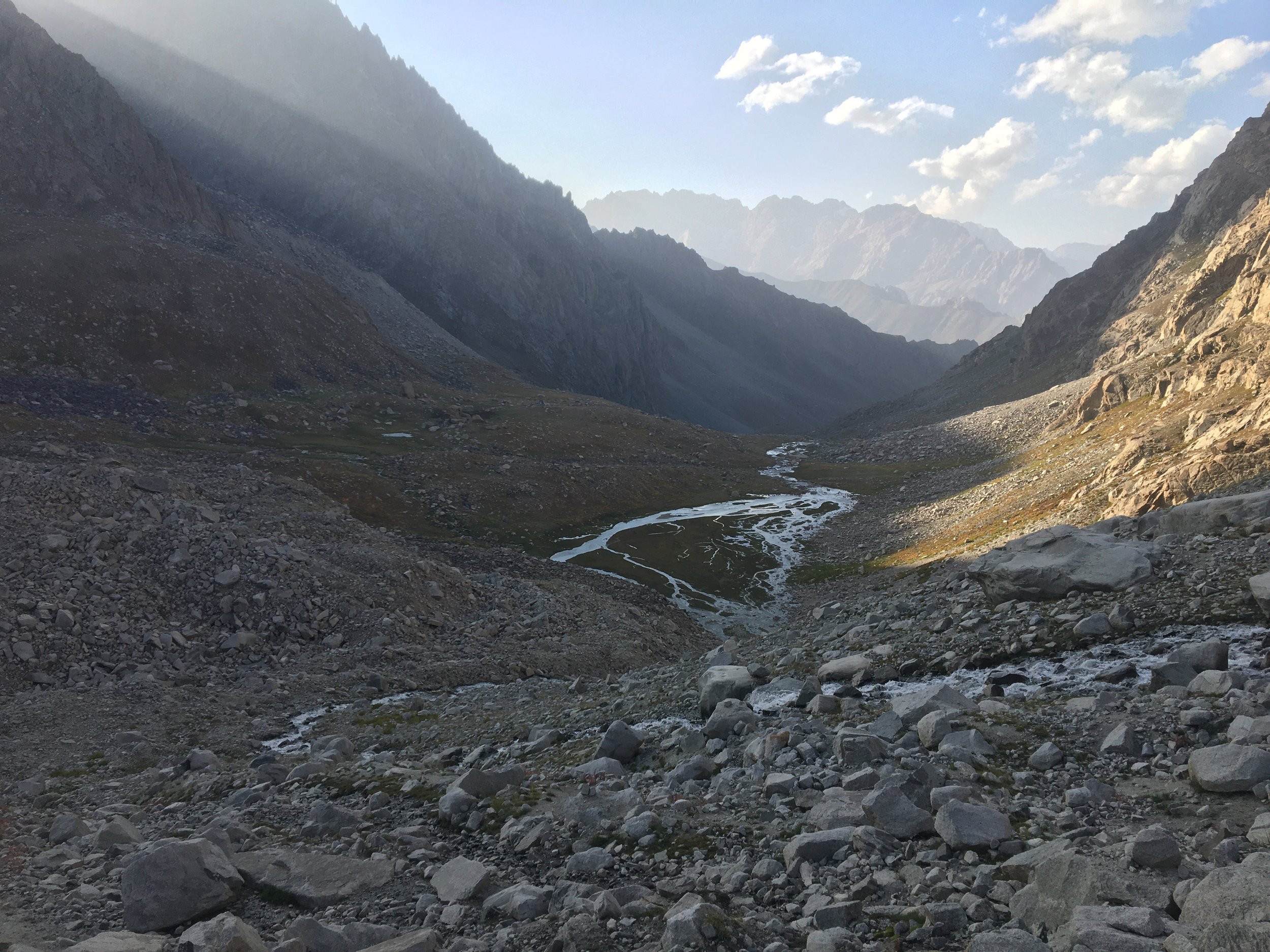
Below the lake after a moderately steep slope is a flat section and the Zombar river (again). Note that the rivers on both sides of the pass are named Zombar. After the flat section is a cascade/waterfall (3330 meters) and a steep descent. Below the waterfall is the terrain I consider unattractive and boring. You will make a very easy river crossing at 3125 meters where the river widens, and then walk down the right bank (east side) of the Zombar river following trails that appear and disappear. In one short section I walked on the dry river bed, very close to the water.
This is an intensive grazing area and you may have to pass by multiple flocks, camps and angry dogs (I certainly did).
Needing to get back to the left bank (east side), I crossed the river at 2315 meters - easily and safely. But June and July may make for an ugly crossing, especially later in the day. Choose your own area to cross based on the conditions. Old maps and guides have listed one or two bridges on the lower Zombar before the confluence with the Diakhandara river and the formation of the Qaratogh (Karatag) river. But they did not exist when I was there in 2021 (probably due to the same flood that destroyed the Mura River’s banks). The most convenient bridge that no longer exists was right next to the Khoja Hassan grave (marked on OsmAnd at 2110 meters). Maybe they will be rebuilt, maybe not.
The good news is that below 2200 meters the Qaratogh gorge is quite beautiful (with many excellent spots to camps). Note that you will then stay on the left bank (east side of the river) all the way until the border guards checkpoint just north of the village of Hakimi. Old maps show bridges crossing back and forth. These did not exist in 2021, and there was a good trail on the left bank, with only two serious bridges (over the Jalchin tributary river and the Payron tributary river).
But if you are on the Pamir Trail, then you will not be going down to the border guards checkpoint, but rather up the Payron gorge to Lake Payron and onwards to the Upper Khonaqo Pass. From the confluence of the Payron river with the Qaratogh river you can reach the village of Hushyori in 4-5 days of hiking, or 3 long days if you are super fast and don’t care about the adjusting your schedule to stay only at the good camping spots.
Additional considerations
The approaches to the pass offer many opportunities to refill on water. But if below the glacier or taking water from the main channel of the rivers, you should treat or filter the water. There’s a lot of livestock in this area. I was able to drink mostly from springs (with less luck finding springs at the lower elevations on the northern approaches).
I dealt with one angry dog on the (south) Zombar river. I made a wide detour around his camp (about 100 meters distance). Luckily the terrain allowed for this next to this camp.
I saw zero other foreign tourists on the southern and northern approaches to Mura Pass, aside from in the village of Saratoq. I saw multiple shepherds at a distance (usually up high with their herds on on the opposite side of a river). I talked to a shepherd resupply caravan along the Qaratogh river (2 young men and three donkeys). I talked to a shepherd along the (southern) Zombar river who was retrieving his cattle (cows are left on their own for long periods of time, as are donkeys and horses). On the (north) Zombar I met a young shepherd returning from a break in his home village below Iskandarkul lake. He had a plastic bottle full of vodka and tried to get me to come join the drinking party at his shepherd camp (750ml of vodka to be split 4-ways). He was a very friendly and funny guy, but saddened that I politely declined the offer (it involved going back up in elevation). I saw every type of grazing livestock: sheep, goats, donkeys and horses.
I’ll end with some of my photos…
At about 3380 meters on the north side of the pass, looking north. I was walking through these boulders, not standing on a clear trail.
At about 3500 meters on the north side of the pass, looking north. The descent is directly down through the rocks.
Standing in Mura Pass, looking west.
Looking south from the pass. Note the small intermittent lake to the far left. Head that direction - not straight down.
