Low and Mid-Elevation Spring & Fall Hikes
in Central Asia
Where to go hiking in Central Asia when the mountains are too cold and snowy
Low and Mid-Elevation Spring & Fall Hikes in Central Asia
The mountains of Central Asia have some great mountain treks and hikes, from day hikes to multi-day treks to months-long thru hikes. The limitation, however, is mountain weather, namely snow and cold. At this latitude and elevation, consider the hiking season to be the same as the North American Rockies and the European Alps. July is OK, but you still have lingering snow on high passes and wet meadows still draining. August is the best season (lowest precipitation, highest extent of snow melt), with some areas in the southern parts of Central Asia being safe to visit well into the dry month of September.
So where can a visitor find hikes that are suitable for the spring and fall season? Continue reading, and note that the focus is on multi-day hikes or longer, not day hikes…
The closed country: Turkmenistan
In the ultra-authoritarian state of Turkmenistan, you are confined to a few different 1 hour-long hikes with a guide as part of an expensive tour by a state-approved operator. What is on offer is limited and is replicated many times over by the exact sort of terrain in the rest of Central Asia’s lower elevation areas (in easier to reach and cheaper countries where you can travel independently).
The low elevation country: Uzbekistan
Uzbekistan is more open to independent travelers and is much cheaper. But this website is not for promoting or hyping an area that doesn’t deserve it. Uzbekistan’s offerings are moderately interesting at best, and its border zone restrictions block the best areas. Those who seem to most enjoy their hikes here are - based on reviews - getting most of their enjoyment from cultural interactions, and not so much the natural terrain. I would consider hiking in Uzbekistan to be a supplement to the main tourist attractions: the historical cities of Samarkand, Bukhara and Khiva.
Uzbekistan’s mountain resort areas of Amirsoy and Chimgan (Chatkal Mountains) and the broader mountain region northeast of Tashkent are not low elevation. If you go hiking here, know that at the exact same time (summer) you could be doing a far more spectacular and cheaper hike across the border in Tajikistan’s Fann Mountains or Kyrgyzstan’s Alay Mountains or Issyk-Kul region. For true low and mid elevation hiking in the springtime or fall in Uzbekistan, you’ll need to go lower.
For multi-day hiking, whether in your tent or hiking from guesthouse to guesthouse (or homestay to homestay), the only relatively easy option is the Nurota Mountains (also spelled Nuratau or Nurata). Asia Hikes has a brief guide to that region, including information on certain hikes (day trips and village-to-village). Nuratau Travel and Nurata Tours are the most connected to this region and are more reasonably priced than the tours that are part of an all-inclusive full country tour. The photos at these links will let you know exactly what sort of scenery to expect (nice, but not spectacular).
You can visit here independently, if you can tolerate the sometimes of annoying level of haggling and negotiating necessary to get a not-excessive price for your transportation and accommodation. The first time I visited I paid for a driver, and the second time in the Nurota Mountains I arrived as part of a long-distance thru hike from Samarkand - which I don’t recommend. But I think that a shorter trip confined to just this area is worth it if you are already in Uzbekistan and you don’t want to spend all your time looking at old historical sites in the cities.
If you are in Samarkand and want to do a hike ranging from a day hike to a 5-day trip, you can go to the mountains to the south of the city. Transportation is cheap and easy. You can go for a hike right from the city of Urgut, or from the village of Yuqori Ohalik just south of Samarkand (usually seen spelled Russian-style as Agalyk). Details here on how to do the day hike from Ohalik. If you want to do something longer, then consider the 100km multi-day hike between Samarkand and Urgut, doable in either direction. Nothing spectacular, but the area is pleasant in the right weather.
These are the easy options that have some reasonable level of information available and some infrastructure for the foreign tourist. There are harder options. One is to visit the southern provinces of Qashqadaryo (Kashkadarya) and Surkhondaryo (Surkhandarya). If you want to explore these regions, I think the neighboring towns of Darband and Boysun are the best bet for a tourist looking to do a hike. The destinations here are the canyons directly to the north, but in general the entire area to the north and northwest looks like there may be some nice hikes. If you want to see example of hikes in this area, see this trip report - but be aware that the route he shows that connects to Shahrisabz goes up to 3300 meters (so not a springtime hike). But the areas he visits closer to Denov and Boysun are fine.
There are lots of areas to explore that have no info available. The key here is to stay as far away from the borders of Tajikistan and Turkmenistan as possible. Unfortunately, as soon as the terrain gets interesting, you are blocked by a restricted border zone. Or, if you want to tent camp, you find out on your first night that there may be areas you can day-visit, but you will not be allowed to sleep overnight in a tent. This rules out many areas near the Tajikistan border in the Qashqadaryo and Surkhondaryo regions, plus farther north in Zaamin National Park. Of note here is the total ban on tourists in the Hisor (Gissar) Nature Reserve and everything at and above the To’palang Reservoir. This rules out all areas near the Tajikistan border, sometimes as far as 45km from the border itself (you can read the law here). The good news is that this terrain is replicated on the Tajikistan side in easier to visit areas with much more spectacular highlights.
For the border with Turkmenistan, next to nothing is known and I would avoid attempting an overnight hike. An example here are the border areas in this area (Google Maps pin) and in the interesting low mountains and badlands to the west. What could happen? As this video from a border zone much farther west shows, you could get a nighttime visit and eviction from the Uzbek border patrol soldiers.
Update: In late 2024 the government introduced increased restrictions regarding tourists in border zones. You now can only enter areas near the border with “an official invitation or documentation from the institutions they are visiting.“ For independent travelers who want to go hiking and camping, this effectively totally bans you from border zones.
All that remains in Uzbekistan are very short desert hikes from your tour guide’s car and back.
Colder and to the north: Kazakhstan
While the country is farther to the north and colder on average during the spring and fall at the same elevations than countries to the south, it still has a hot summer that is not suitable for hiking except at higher elevations.
Kazakhstan has some potential for low and mid elevation hiking. But generally, it seems that day hiking after a long and relatively expensive drive is what to expect in Kazakhstan if you want to hike the lower elevations in spring and fall.
The Mangystau desert in far western Kazakhstan looks very interesting with its badland formations, but is reachable only with an 4-wheel drive off road vehicle and preferably with a local guide. And once there you will find no water and zero infrastructure to support a longer hike. There are massive distances between the various attractions. It’s a driving tour.
Altyn Emel National Park looks interesting, but a brief investigation will tell you that this is mostly a car-driving tour - with bicycles at a minimum needed. Why? It’s a bit of a desert, and very big. It looks good for day hikes if you have a vehicle. For any sort of longer multi-day hike, know that there are few locations with reliable water here and connecting the various attractions to a longer multi-day hike would be difficult and extremely boring on road walks (with a central preservation area off limits to visitors). Furthermore, there are layers of bureaucracy that may block you as a hiker (or they stop you out of concern for you own safety).
Charyn Canyon is popular with day hikers and overnight campers - they seem to enjoy it. But their visits are confined to a small area. A longer trek along the length of the canyon is likely very, very rough. This guy hiked the north part of the canyon, and it looks like endless scrambling and bushwhacking (I see no trails on satellite). Can you continue south? Maybe, maybe not. This should be considered exploration. If you do go exploring, know that the river water is muddy in the spring, and clear in the fall (relevant to filtering drinking water).
Head for the south: Kyrgyzstan
Some tourists show up too early in the season to an area well-known for its high mountain summer treks - the Issyk-Kul region. At the lower elevations on the south shore of the lake you will find eroded badlands hikes of 1-2 hours (such as the Russian-renamed areas Skazka Canyon and Mars Canyon, plus Ak-Say Canyon). For mid-elevations, snow will confine you to road walks that make up the beginning of the high mountain treks, but without being able to reach the elevations where the famous views begin.
Near Bishkek you can do the very short lower elevation parts of Ala Archa National Park in spring and fall - basically a half-day mid-elevation hike.
For early and late season hiking in the spring and fall, I suggest not spending too much time in the relatively high, cold, and wet north of Kyrgyzstan, and heading south.
The popular southern mountain village of Arslanbob (at 1500 meters) has some good mid-elevation options, and plenty of tourist infrastructure. I’ve been here, and I think it’s fine for full day hikes. Spring is rainy, but late September and early October are perfect if you want nice dry weather and to be there for the walnut harvest in the forests.
The south of Kyrgyzstan, like the north, has same amazing high mountain trekking. My personal view is that the south, by which I mean the Alay Mountains, has better a better variety high mountain trekking than does the north, and with drier trails and less tourists. This video from a late season hike shows that well. If you show up in the spring or fall, the local tour operators do have some itineraries available at lower to mid elevations - but they tend to promote those trips with images of treks at high altitude.
Day hikes at lower and mid elevations can be found at Abshir-Ata Waterfall, Laglan Canyon, Murdash and Kojo-Keleng (also spelled Kozho-Kelen), among other destinations - I would lean towards Kojo-Keleng for multi-day hikes (plenty of homestays and guesthouses, nice variety of scenery). None of these destinations are easy to reach while traveling independently.
If you want to do a longer route, there is a thru hike of the lower elevations of the Alay Mountains. Info coming later in 2025 on that route.
A little bit of everything: Tajikistan
Tajikistan is famous for the (high and cold) Pamir Highway. In the spring and fall in that general region you will be confined to hiking from your homestay up the lower and less interesting elevations before hitting snow and bitter cold. The dry eastern Pamirs are particularly cold, and there are no lower elevations here (for example, the town of Murghob is a low point at 3600 meters). The lowest elevations of the broader region have few interesting hikes in the spring and fall season, but the overnight hike to and from Jizev is a notable good one at mid-elevations (from about 2100 meters to 2500+ meters). You can get to this mountain gorge as early as mid-April and visit as late as end of October (with 3-season trekking gear and clothing). Watch my Jizev video from the beginning until about 5:50 when the higher elevations start.
It’s western Tajikistan where you finally get down to lower elevations. Near Dushanbe there are some day hikes that you can do in the spring and fall. They are OK at best, with the most interesting one (Shirkent) often involving unpredictable and difficult negotiations with border guards (example: one group was told to go to the border guards headquarters in a town an hour away and return with a permit). Usually referred to in English as “Shirkent National Park,“ it is officially Shirkent Historical Natural Park. Local tour companies seem to make the trip go smoothly (at the moment only one company advertises a trek here). This video shows what should be the main destination: the “Shirkent Barrier“ geological formation.
There is a long distance trail that goes across southern Tajikistan that is still a project in the works, with the full route only being possible in the fall. The eastern areas of this route are inaccessible in the spring rainy season (and summer is way too hot). This route has plenty of difficulties. Full info at the link.
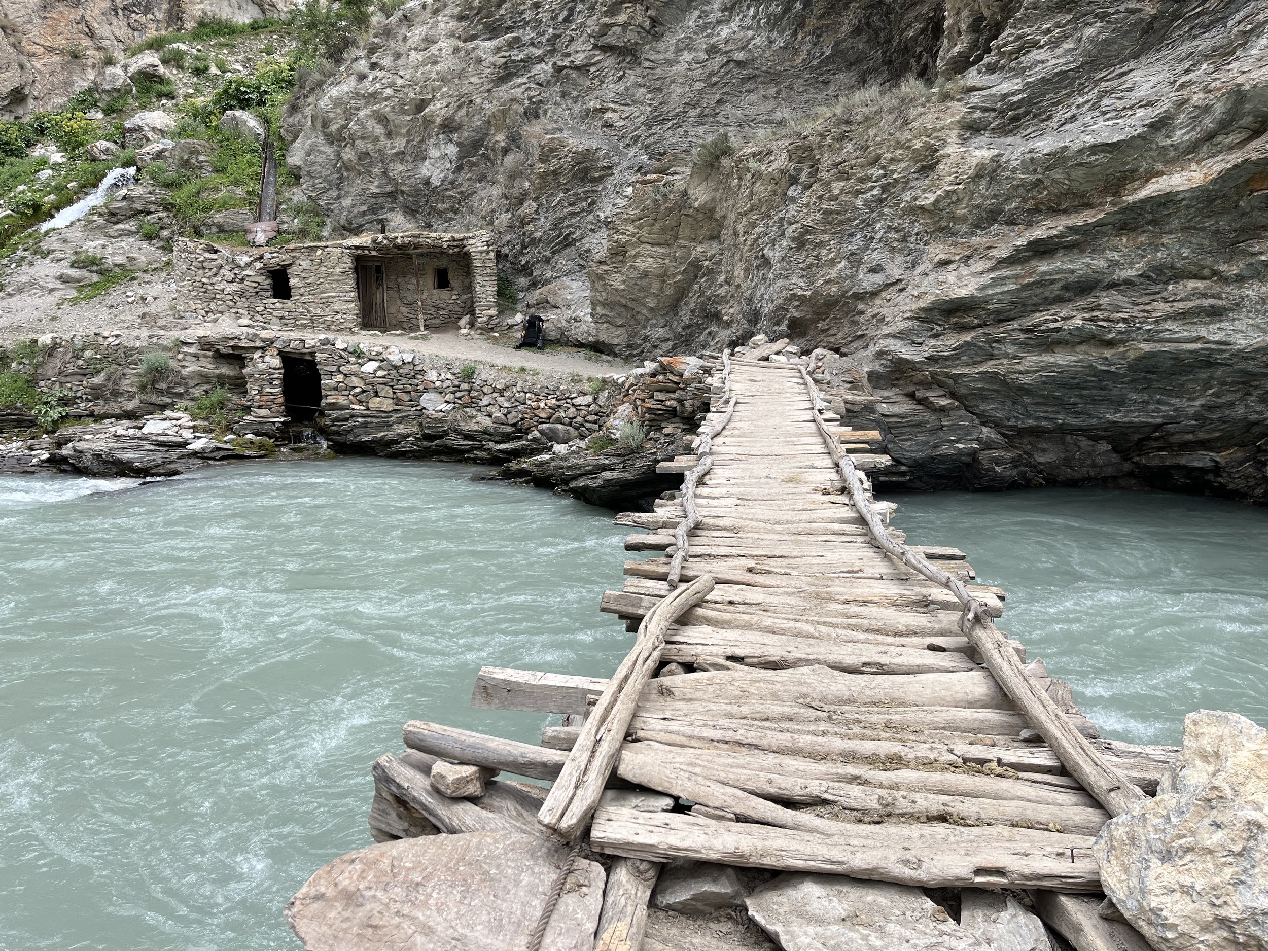
The Yaghnob Valley has hiking trails between about 2200 meters and 2700+ meters that are good for (rainy) spring or (dry) fall hiking. Info on the Yaghnob here and here. For the spring season, the Archa Foundation notes that to access the valley in the spring, you can’t drive all the way in, and the walk in will take you across large avalanche debris fields. Yaghnob scenery is always pleasant, but not always spectacular. It’s more so a destination focused on cultural interactions.
The lower and mid-elevations of the Fann Mountains have a spring and fall hiking season that tourists don’t seem to know about. In the spring through mid-summer the passes and higher elevations are blocked by snow, but in the fall you can hike the high elevations until the first snowfall - which can sometimes come very late (late September through early October). At lower and mid elevations in the Fann Mountains you can hike from early May until mid-October (with the fall being drier than the spring). Of course, most of this time it will be a game of finding a route that does not require going through a high pass.
The longer-distance hiking in this region that is easiest to access and in an area with a reasonable amount of tourist infrastructure is the Zarafshon Valley Trail, which can be done in the spring and in the fall.
~~~
This compilation is not a complete list. Aside from border areas, strategic zones and Turkmenistan, you can find all sorts of places to freely hike and camp throughout Central Asia at low and mid-elevations during the spring and fall. Look at the elevations for a region, then look at the same area on a satellite map and see if anything interests you (note that local people do upload photos to Google Maps place markers). For some of these areas, if you don’t speak a local language you will need to be very patient and able to figure out how to get some sort of transportation in the absence of official public transportation.